
This is the tale of a weeklong off-road adventure up in Colombia’s High Andes. It’s story of despair, partial triumph and how I found myself wandering through the wilderness looking for a man with a horse, who ominously goes by the name of Mr Machete…
Avid followers will recall my recent moans about road weariness and declaration to pursue paths less beaten for the South American leg (see here). So in a bid to ‘walk the walk’, I set my sights on Los Nevados National Park, a wonderfully isolated, high altitude wilderness, which is home to some of Colombia’s highest peaks and most active volcano. In the small world of adventure cyclists the myriad of tracks and trails seems to have barely been explored and so armed with minimal ‘intel’ I rather ambitiously decided to have a crack at a North to South crossing. Prospects were looking bleak from the outset, with a local guide informing me it was impossible, but I was so enthralled by the notion of such a route that I decided to give it a crack anyway. I could rabbit on forever about the frankly absurd series of events that followed, but I’ve instead opted for a ‘photo journal type thing’, almost, dare I say it, like a ‘proper’ blog.
DAY 0
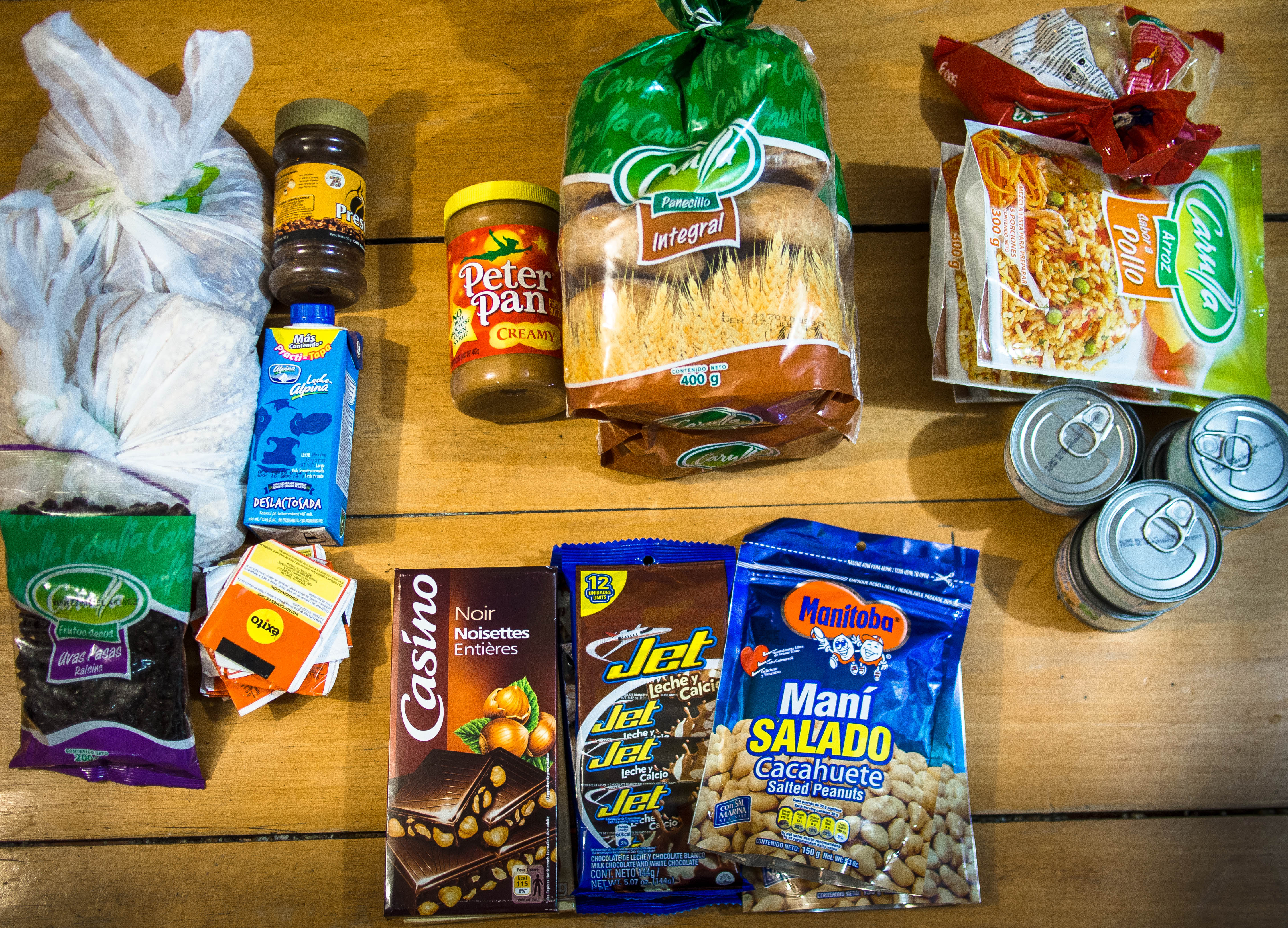
First off, it’s shopping time. Buying a week’s worth of food for the mountains is effectively the opposite of the selection process a weight conscious girl might go through in a supermarket. The calorie is king and the more you can pack in per gram the better.
DAY 1 – Up
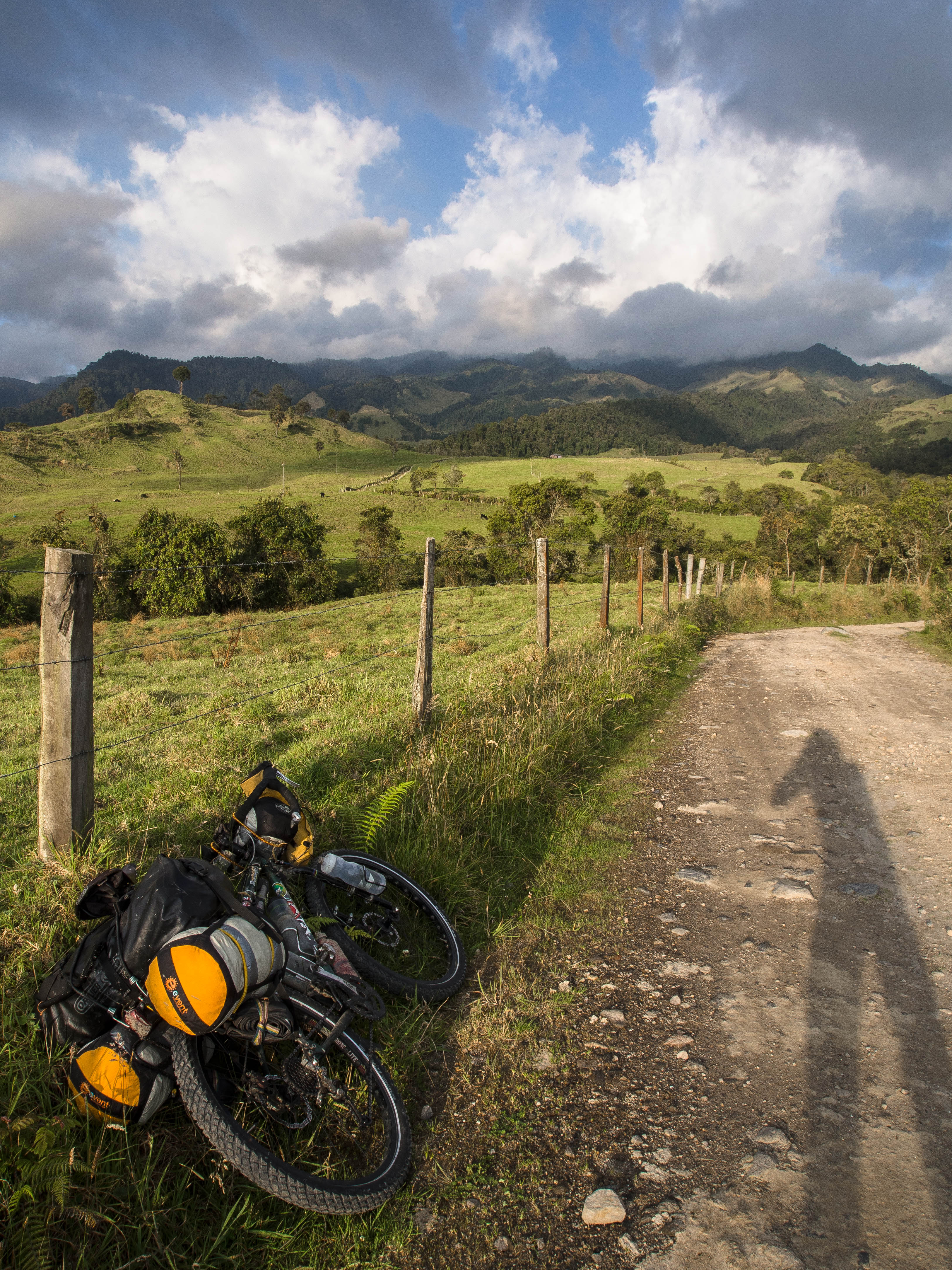
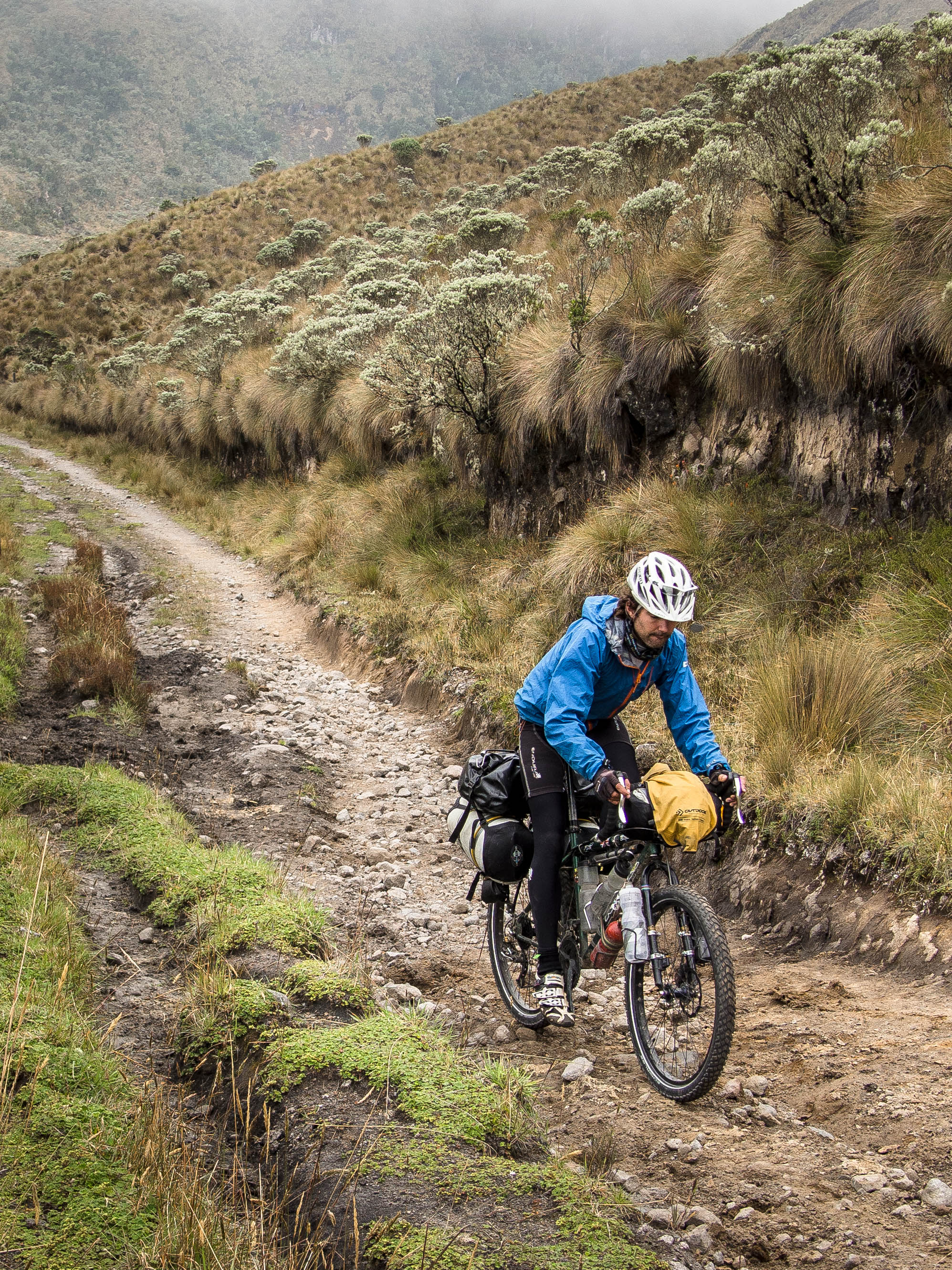
On the road things started innocently enough (if you can call a relentless uphill dirt track innocent), passing through farmland and watching the numbers on the altimeter gradually creep up.
This is the domain of small time dairy farmers, with fresh milk subsequently hauled down to the city and factory processed into its shop ready UHT form.
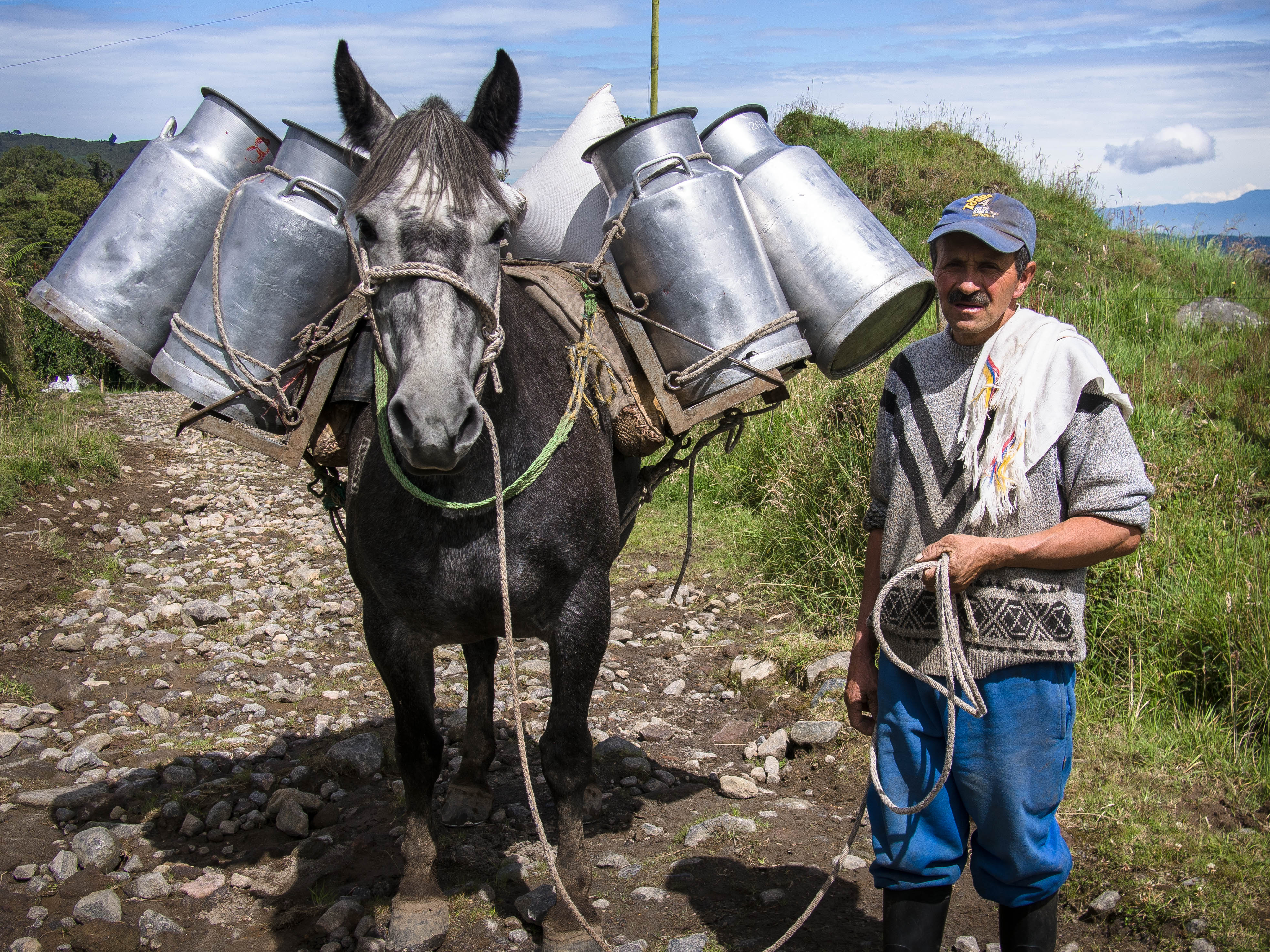
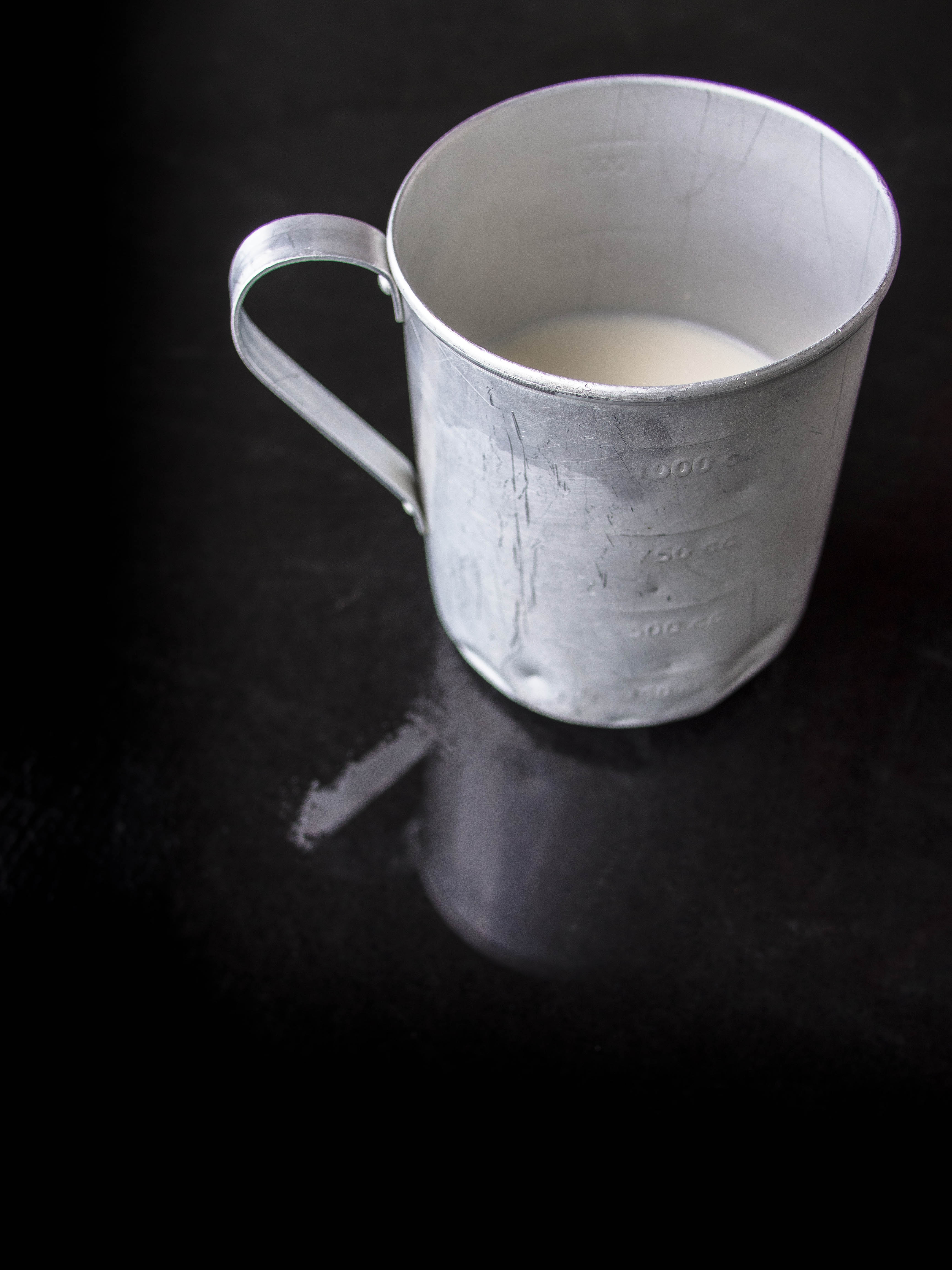
Having been deprived of ‘real’ milk for months I jumped at the offer of a taster. Unsurprisingly, amazing stuff.
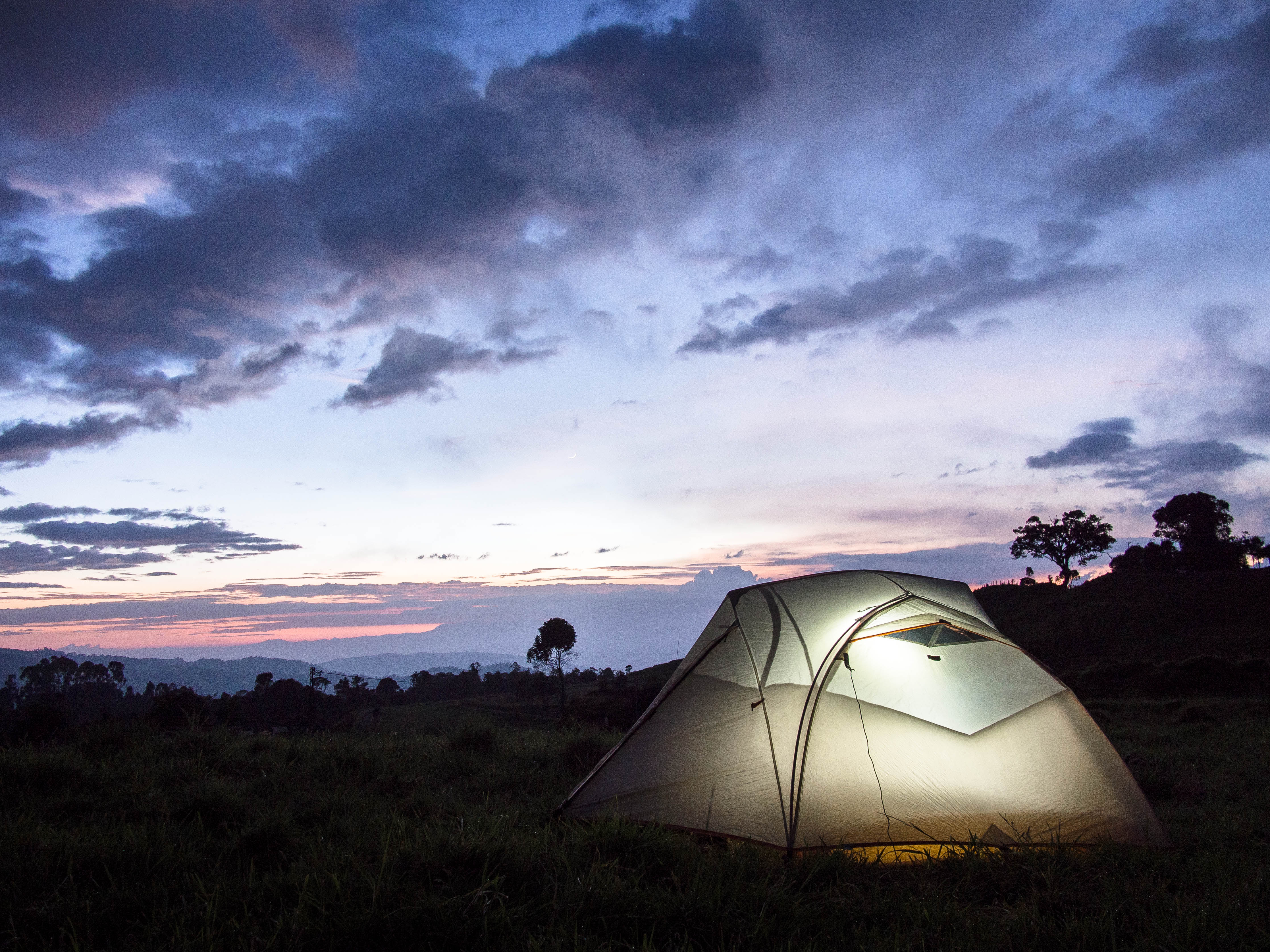
The first nights camp was at around 3000m in the field of a slightly bemused farmer.
DAY 2 – More Up
The theme was similar the following day, with more uphill grinding on deserted, stony tracks.
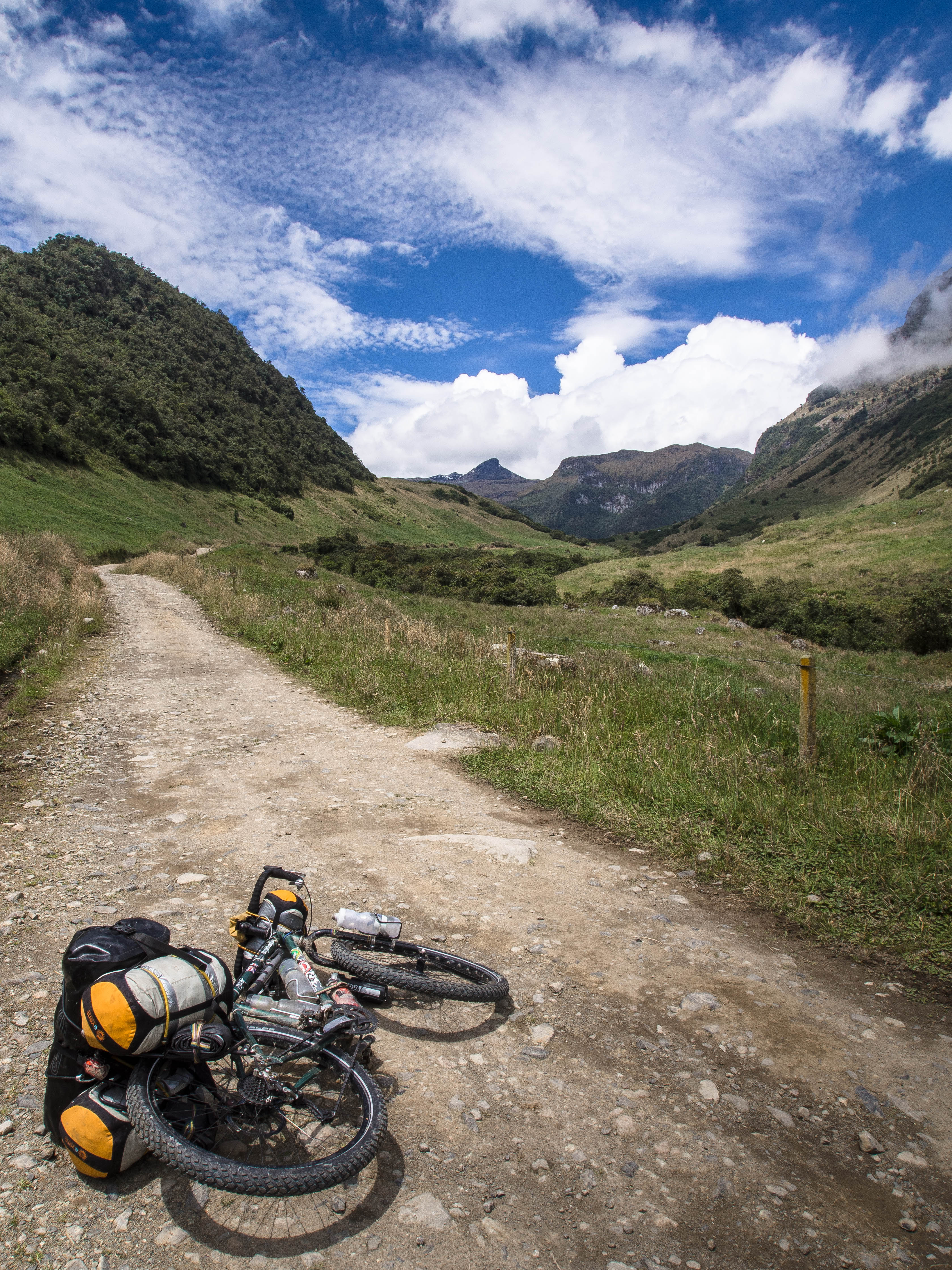
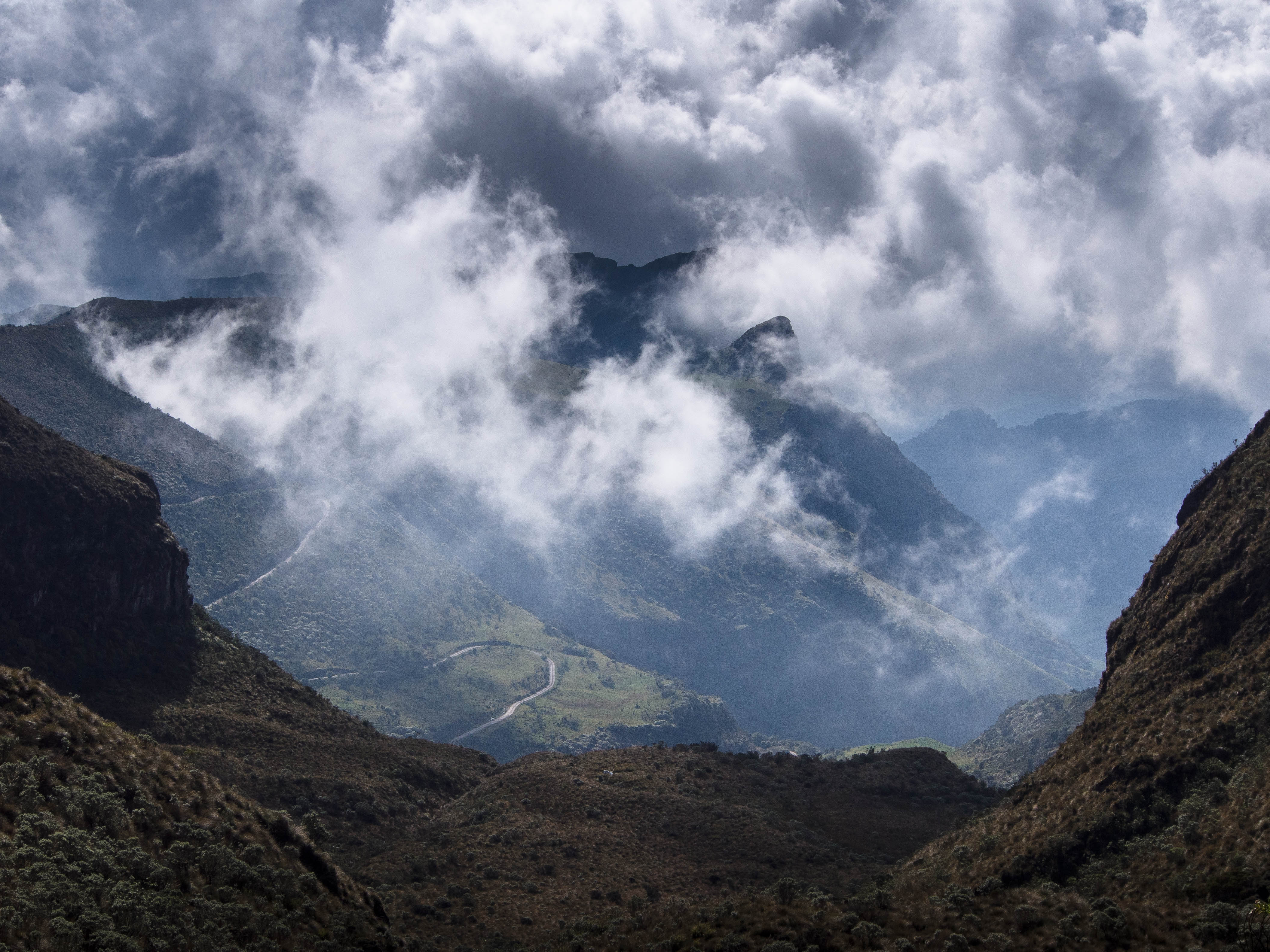
Approaching 4000m though, the increasingly rarified air presents an additional challenge for the unacclimatised rider, with that familiar breathlessness and pounding heartbeat following every big exertion. At any rate, a good excuse to stop and take in the view of the valley and winding track below.
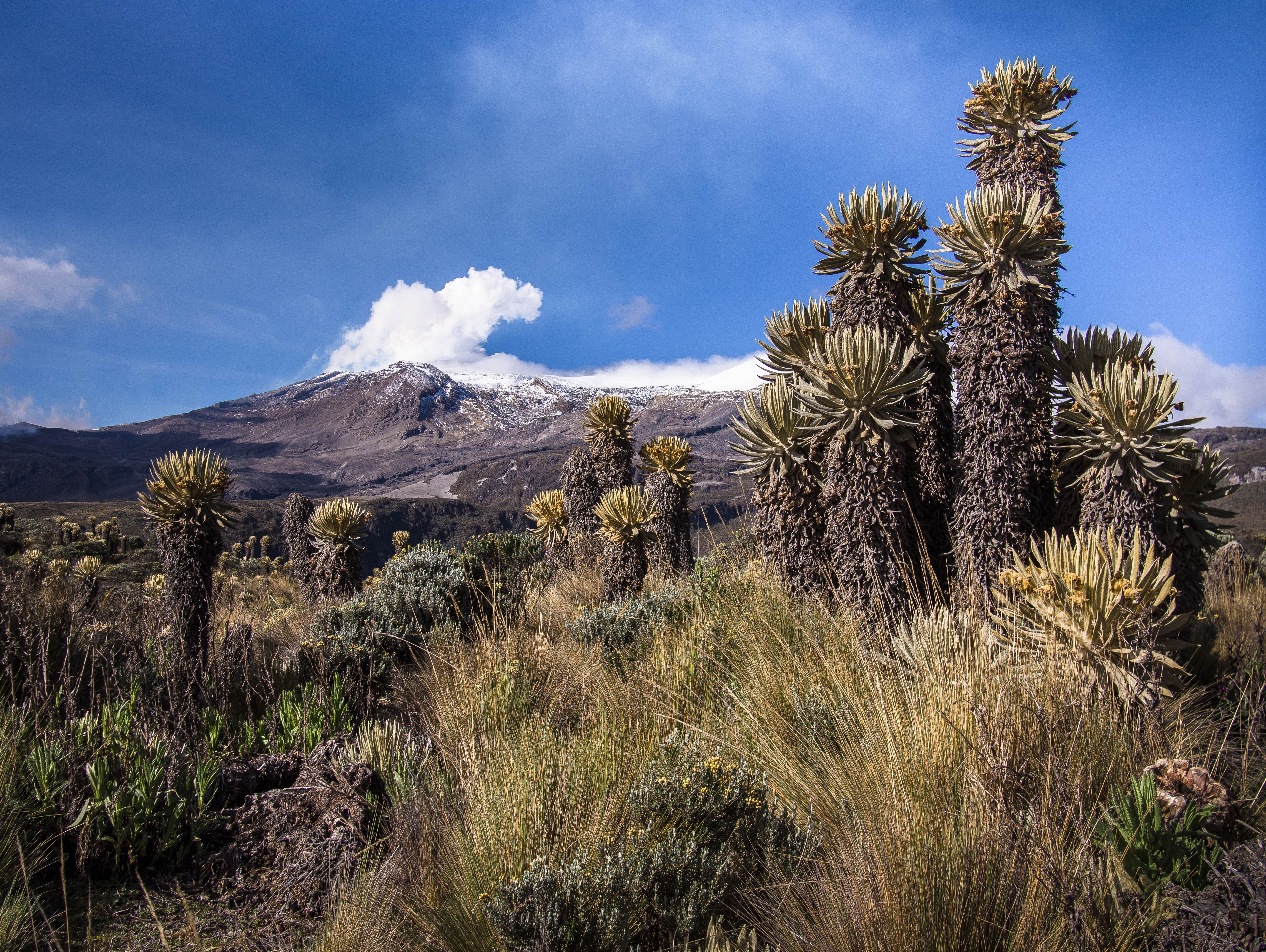
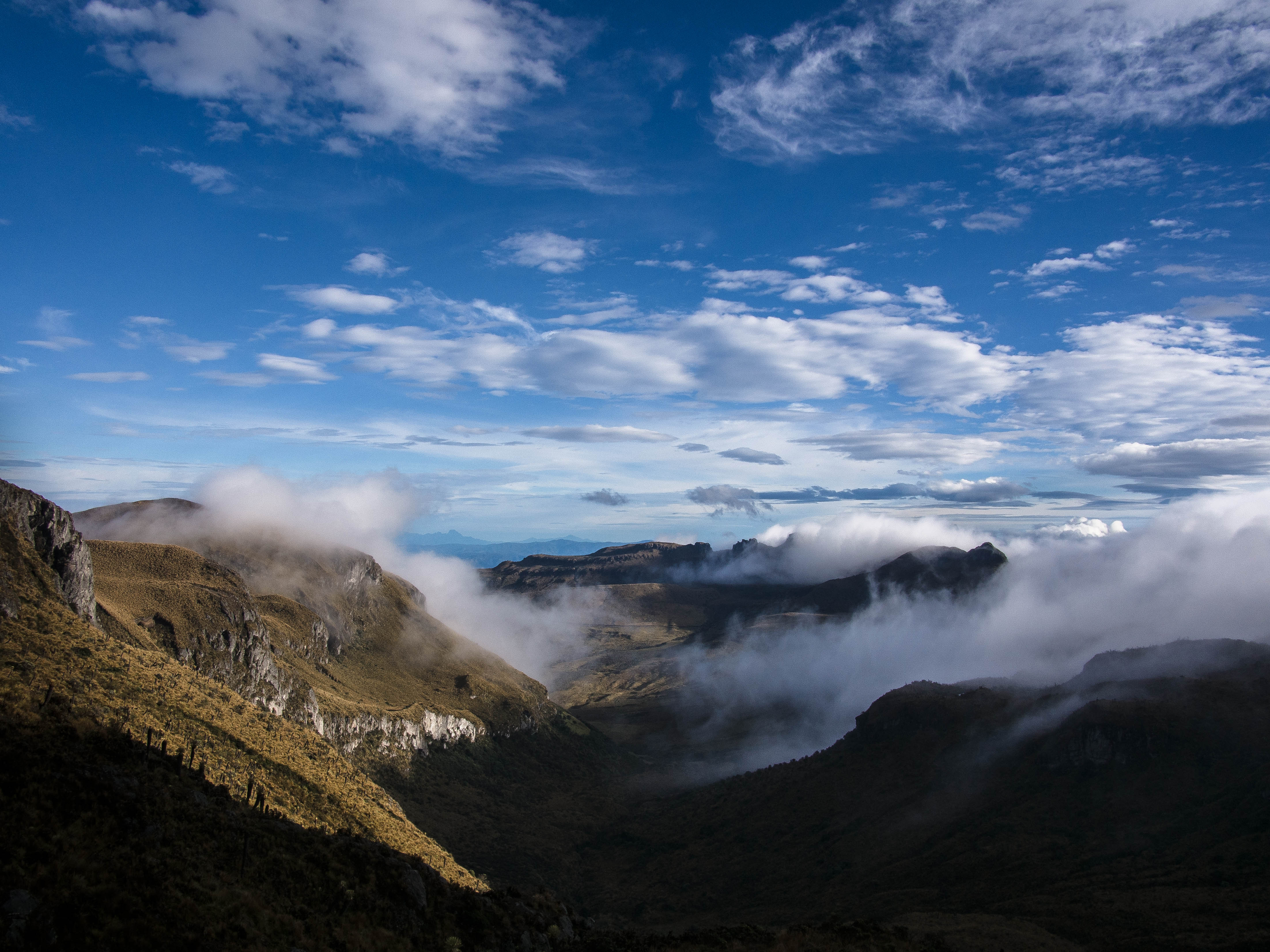
Before long grassy farmland had given way to the magical world of high altitude Paramo.
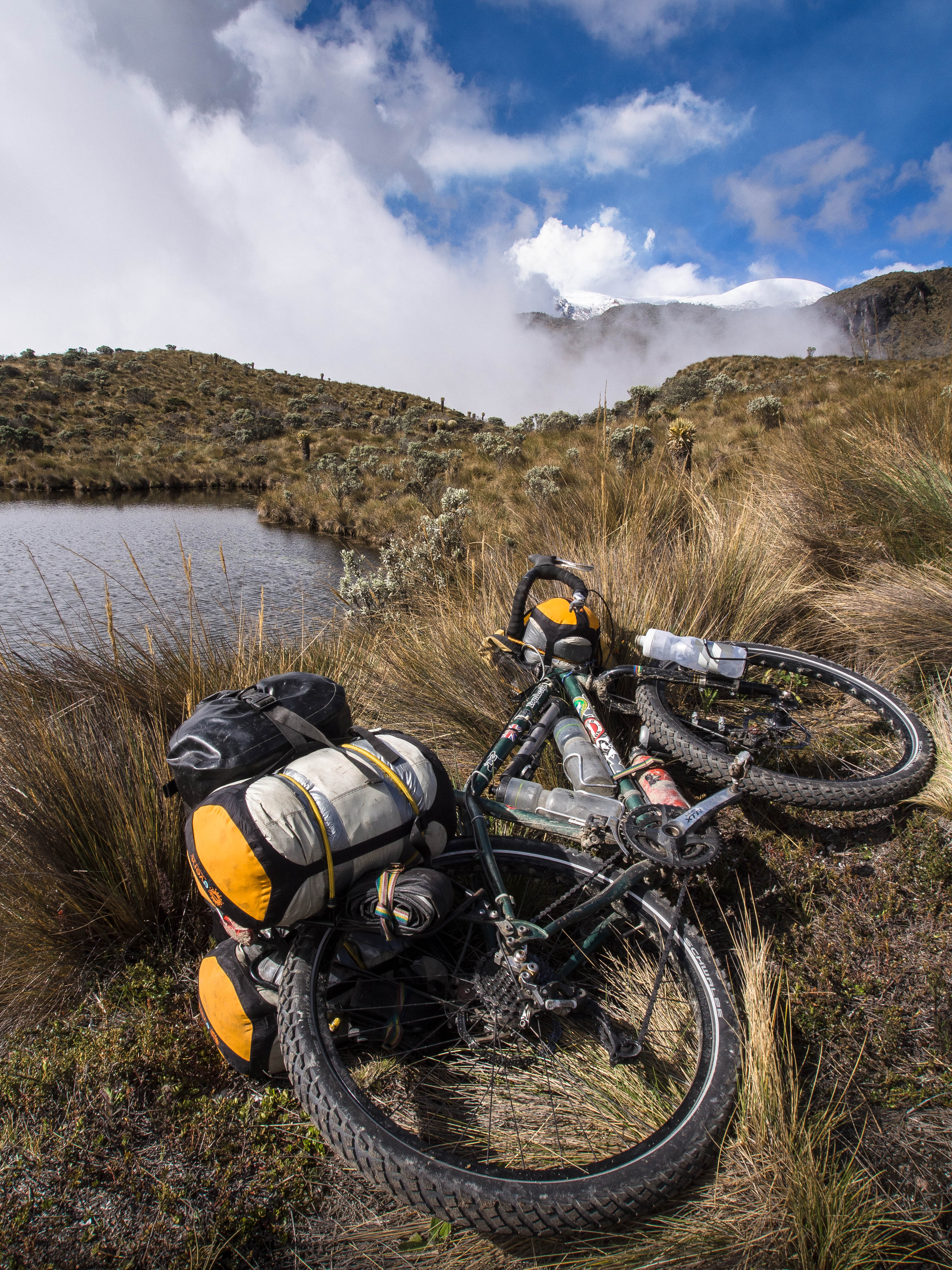
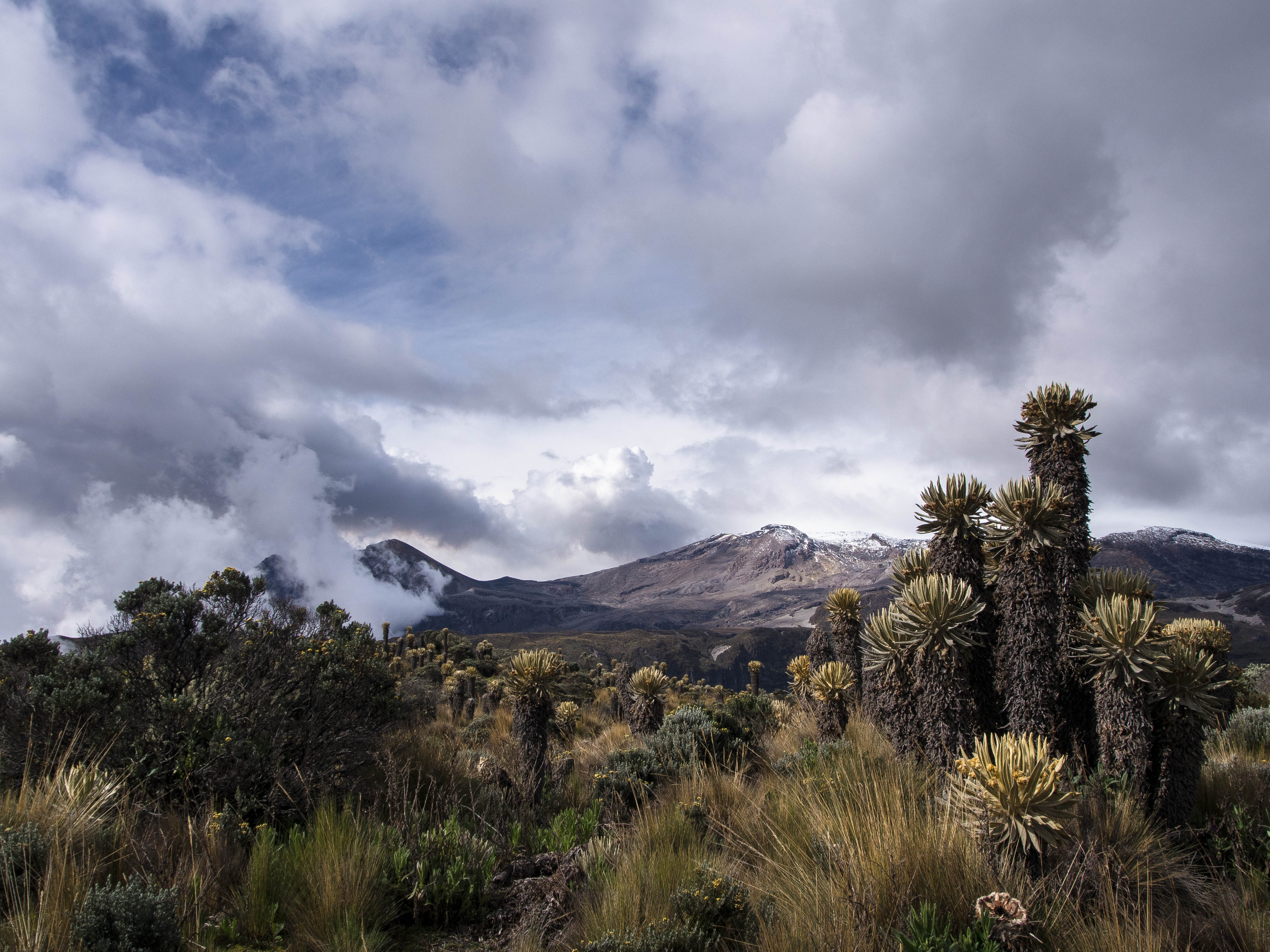
An expansive wilderness dotted with all manner of strange plants, set against the backdrop of the snowy peaks of the Nevados.
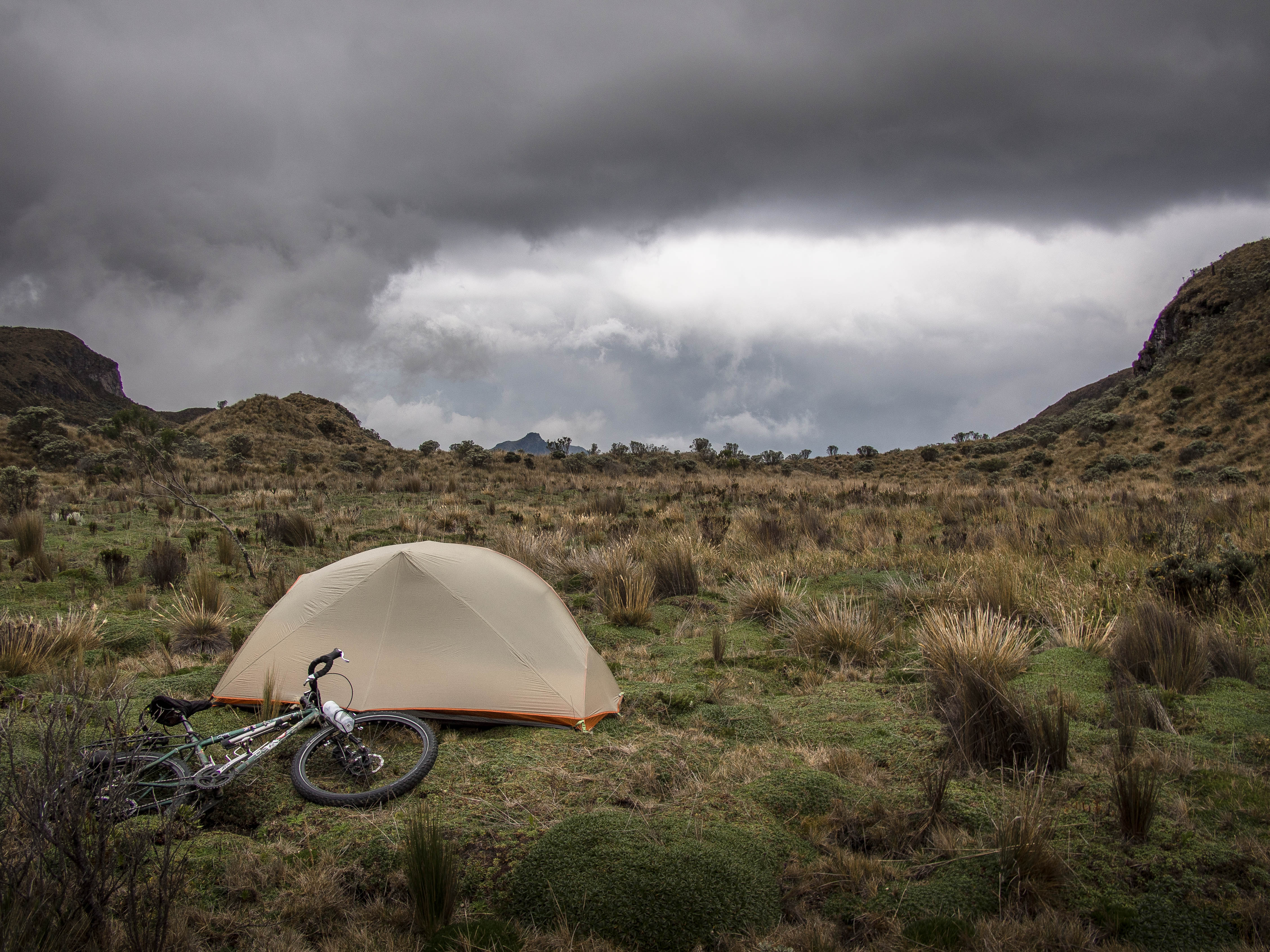
Paramo does however, make finding a feasible camping spot somewhat problematic, bringing back memories of those first days up in Alaska’s boggy Arctic Tundra. The target site always looks appealing from a distance, but then as you move in for closer inspection it invariably turns out to be another patch of uneven marshland. Camp 2, at 4100m, was the result of a fair bit a searching…
DAY 3 – Aborted Side Trip
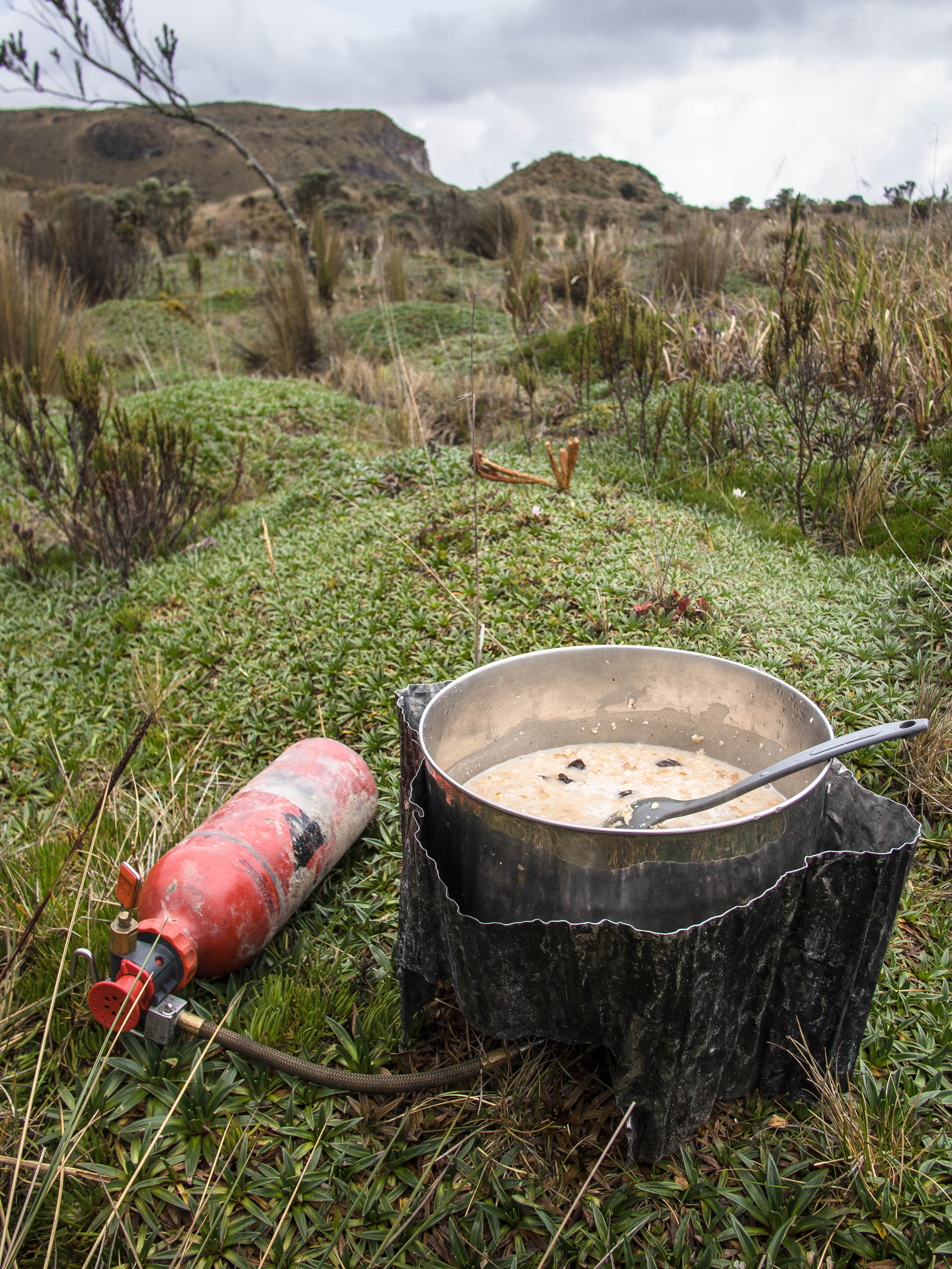
Breakfast of champions; oats and raisons. Ok for a couple of days, but by day 7 soil almost starts to look more appealing.
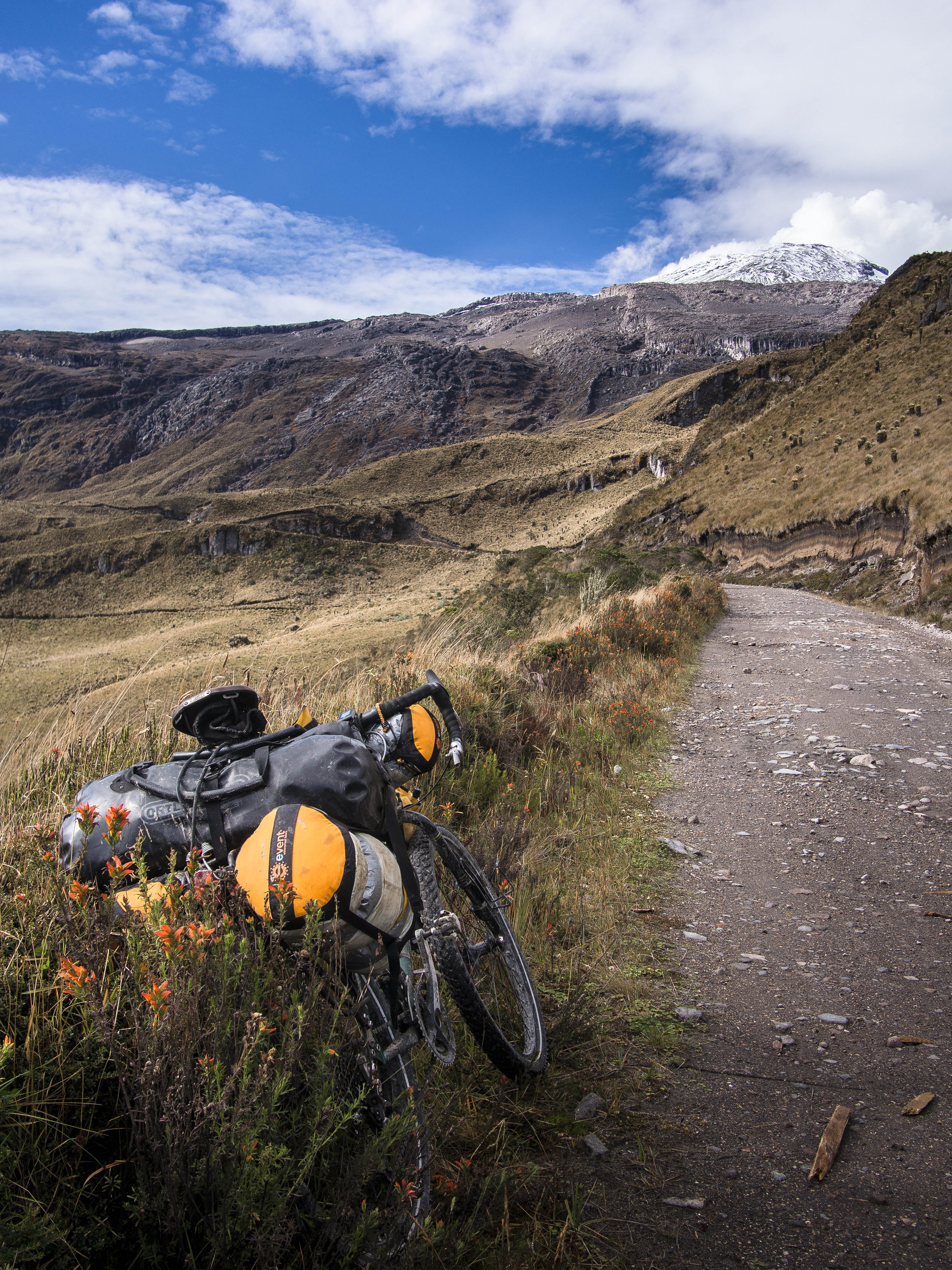
The plan for the day was to make a side trip up to the lofty 4800m pass adjacent to the magnificent Nevado Del Ruiz, Colombia’s highest and most active volcano. I’d been informed that the 20km stretch of dirt road leading up to it was off limits these days (something to do with volcanic activity….), but I thought I’d give it a go anyway. After gingerly jumping the gate, I thought I was home and dry, but not long after I ran into a park ranger driving towards me. Damn. He of course explained what I already knew: the track was closed and I must turn back. And despite playing down my knowledge of Spanish, simply repeating “But I am on bicycle”, it didn’t fly and back I went.
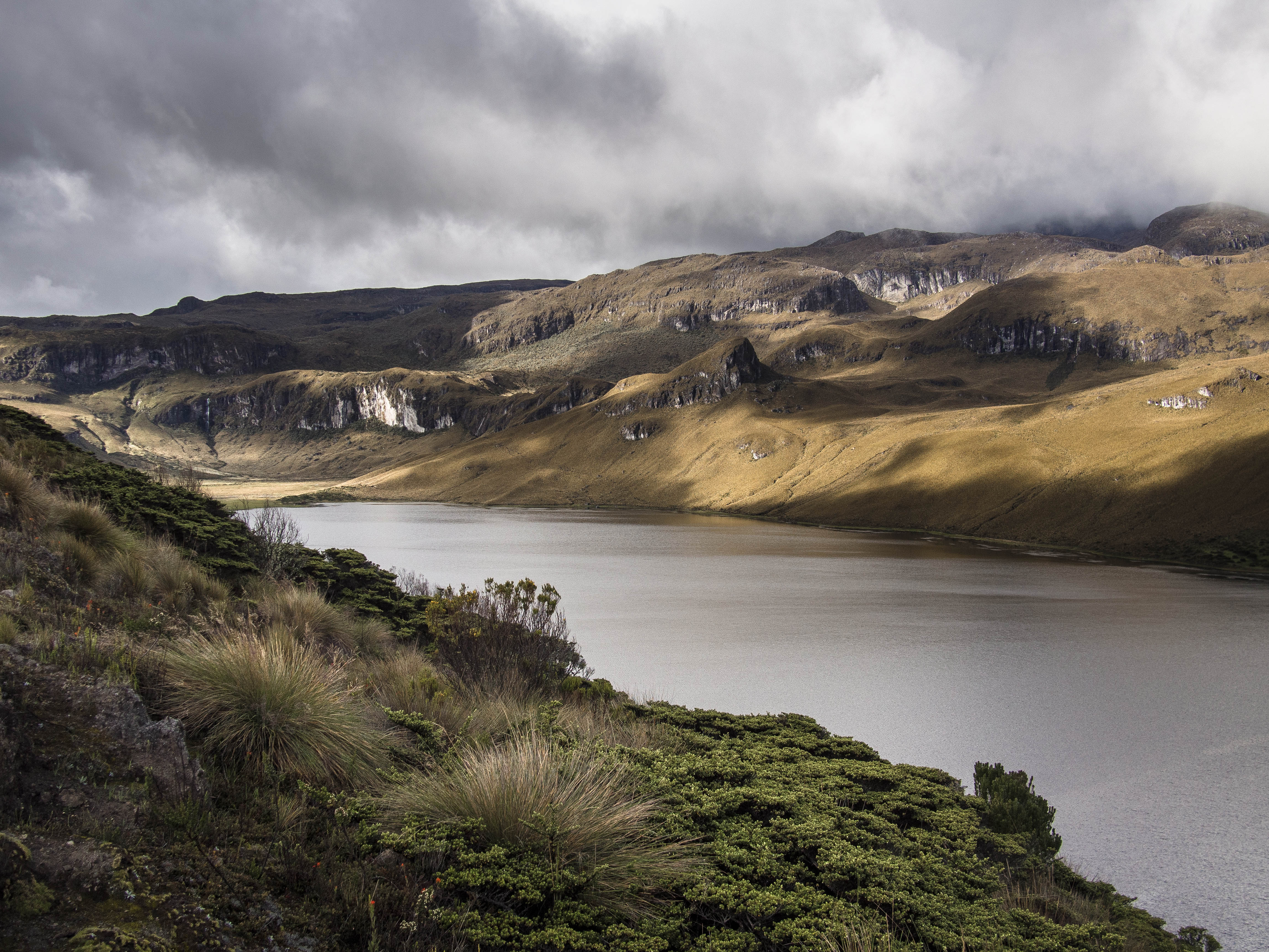
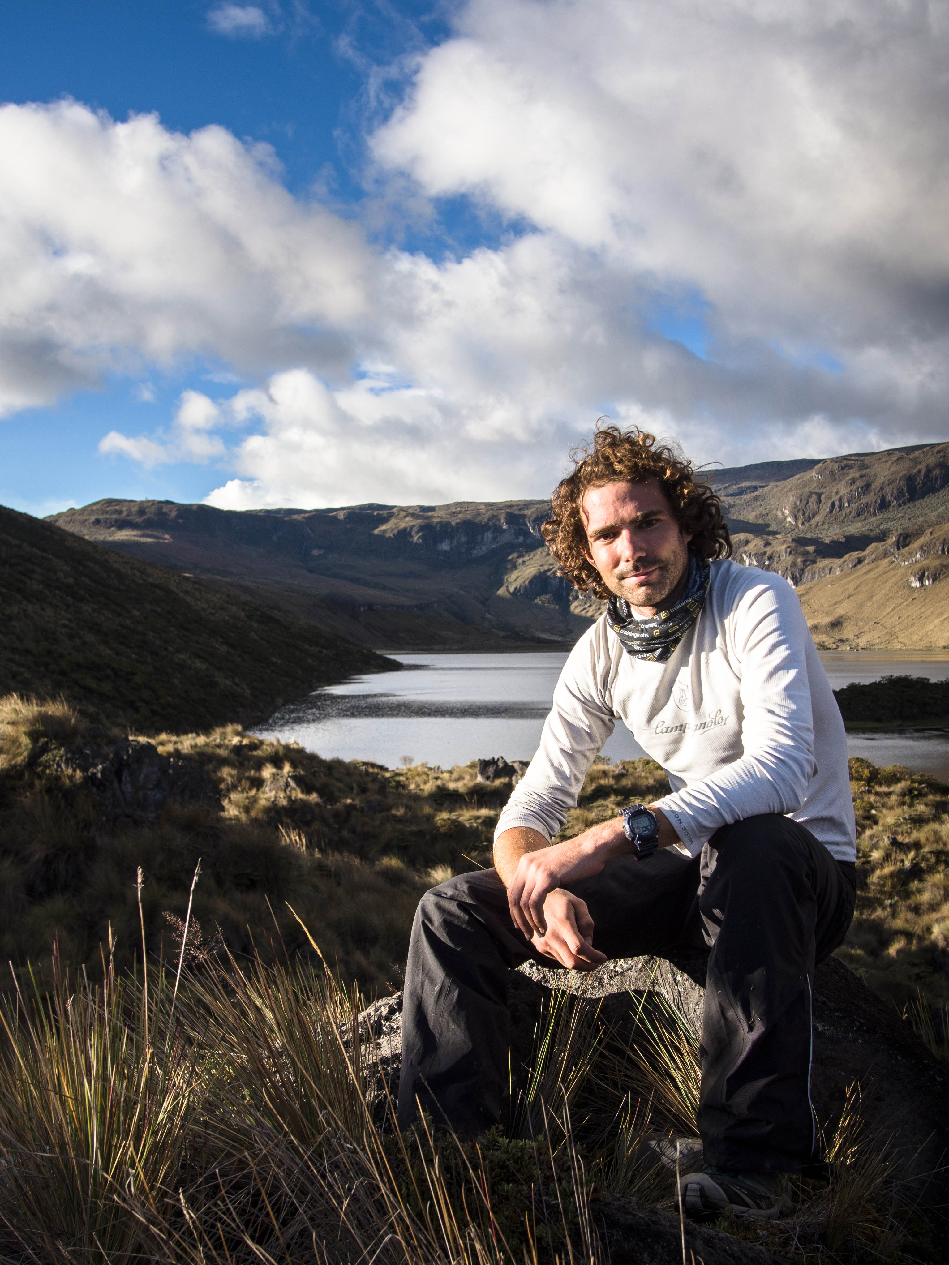
So it was back to the main objective, forging a way southwards. I therefore packed up and moved on to the spectacular Laguna Del Otun via a fairly technical singletrack route, involving a not insignificant amount of uphill pushing.
DAY 4 – I Need a Horse
Given the difficulty of reaching the lake and the fact I knew the trails were significantly more challenging from here on, it was painfully clear I couldn’t continue on a heavily loaded bike. What I needed (obviously) was a man with horse to carry my clobber, leaving me free to tackle the technical terrain unhampered by luggage.

I’d previously been recommended such a man, the elusive Mr Machete, and so I set off on a three-hour hike across the windswept Paramo to track him down. Quite a mission in itself and so when I arrived at his house only to be informed by his wife that he was away, it was a bit of a blow. Clearly sensing my dejection she plied me with coffee and I set off for the return slog back to the lake, unsure what my next move would be.
DAY 5 – Despair
Not one for giving up easily on an idea, no matter how ridiculous, I woke up with a renewed sense of optimism and decided to press on southwards regardless. My slightly bizarre plan was to stash my luggage at the ranger’s hut by the lake and proceed with only my bike and a daypack. I knew if I could make it across the mountains to a large farm called ‘La Primavera’ which is used to accommodating hikers, I’d be able to arrange for a ‘horseman’ to go back and collect my stuff. Foolproof.
So, armed with a map that bore little or no relation to the actual trail network I set off across the Paramo. My blind optimism took its first hit when the trail I’d been pointed in the direction of soon petered out to nothing. This left me having to forge my own way through the difficult terrain in the hope of connecting with another trail. The going was tough, insanely tough. So tough that it was the first time in the trip I’ll admit to being brought to tears of despair. Riding the bike was impossible, leaving me lugging it up and down steep, marshy mountain slopes, making painfully slow progress and frequently collapsing out of fatigue. It was ridiculous and it quickly became evident there was no way I’d make it. Returning via the same route was possibly the most logical option, but by the point I’d actually admitted defeat the prospect of battling through the same hellish terrain again was difficult to bear.
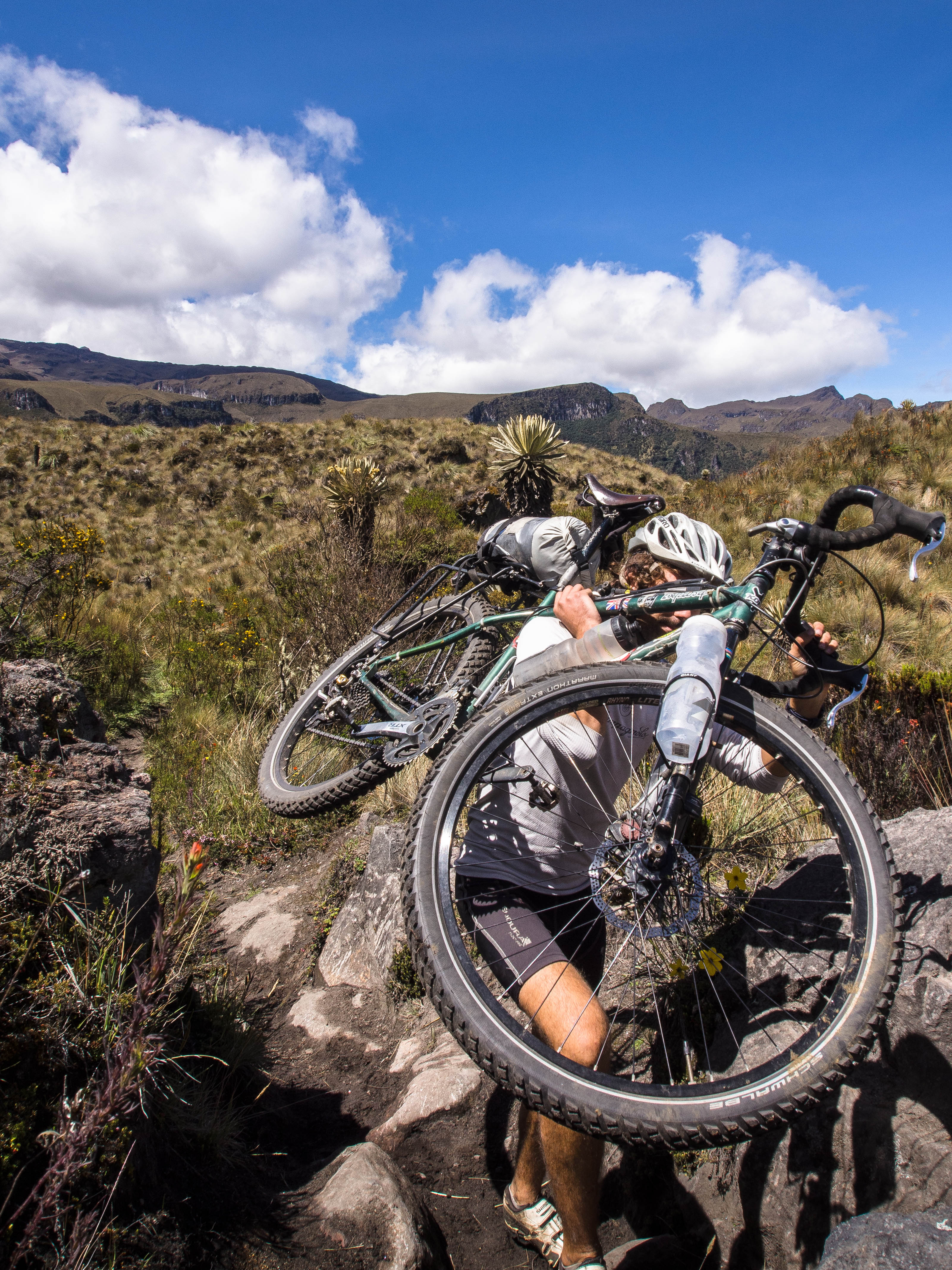
Instead I pressed on and reached an actual trail that I knew would lead me back to familiar lands. Steep gradients and large rocks still meant as much time was spent carrying the bike as was spent on it though, and given the rapidly reducing number of daylight hours it was doubtful I’d make it back to the lake in time. Instead I decided to aim for Mr Machetes farm and kip there for the night. I arrived a wreck; completely drained and left convinced that ‘armchair adventuring’ is the way forward.
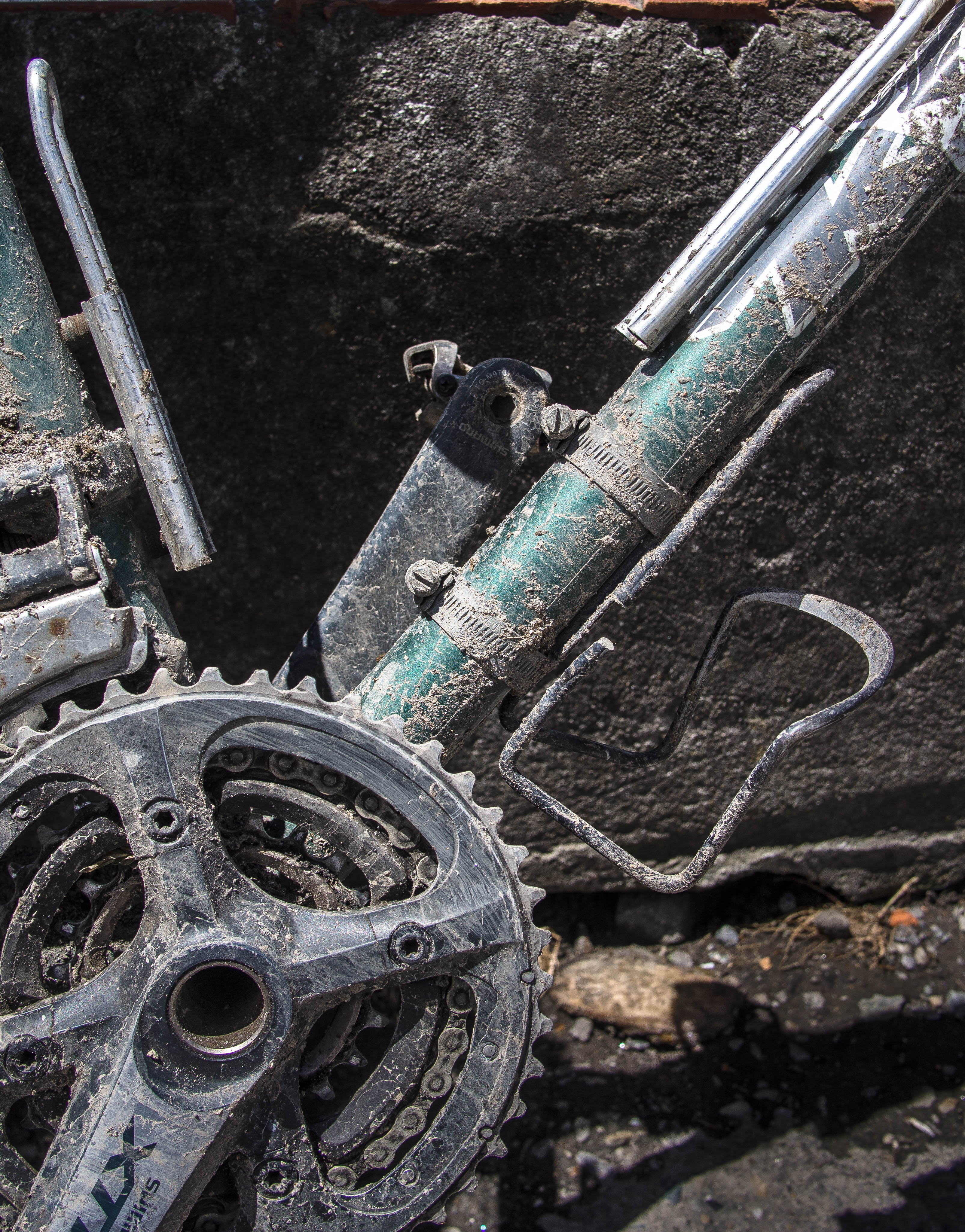
As evidence of the battering both body and bike took, all three of my bottle cages decided to shear off in protest.
DAY 6 – A New Plan
With the idea of forging a way southwards finally extinguished, it was back to the lake to re-group and devise a new plan for getting down from the mountains. Food was now running low and I couldn’t afford to hang around much longer.
The most realistic option was to retrace my steps and descend the way I had come, but that represented absolute defeat and would mean subsequently having to cross the mountain range again via a paved highway. I was desperate to rescue something from the whole endeavor and instead decided to try a West to East crossing. This would get me on the right side of the mountain range ready to start the next leg, but involved one slight issue…. I would have to cross the forbidden section I’d attempted previously. But how to get through without being caught? The painful answer was, of course, to go under the cover of darkness and thus this became the plan. The following day I’d camp as close as possible to the ‘forbidden zone’ and start my assault on the climb that night.
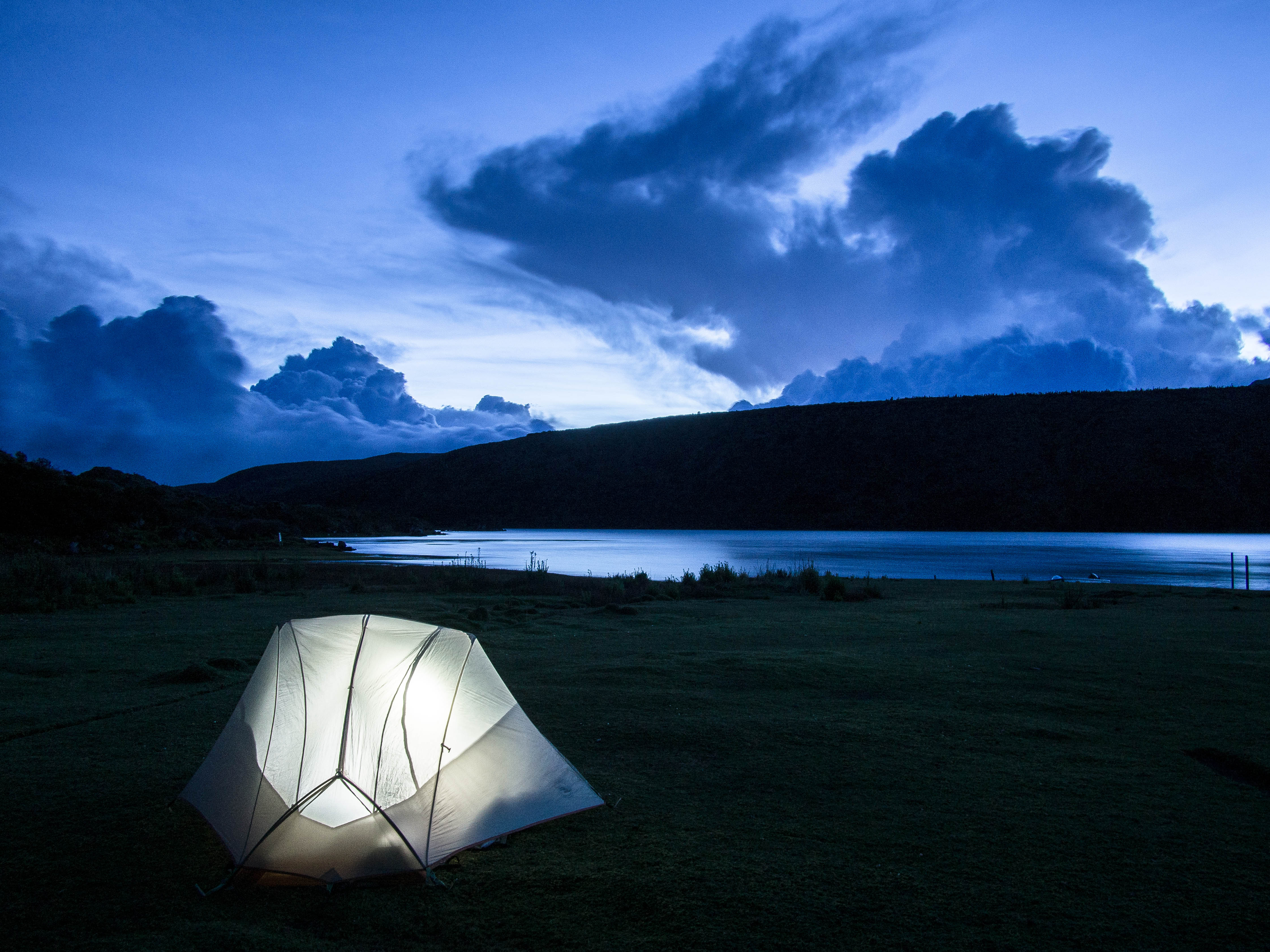
My last evening at the lake was especially stunning, kicking back gazing at a lighting storm blazing away in the distance and the star filled sky overhead. This was the wilderness experience I’d so desperately been seeking and I sat back and laughed at the absurdity of the events that were unfolding.
Note: The route closure, in my opinion, seems a completely over the top reaction to past volcanic activity. I don’t want to give the impression of heading into a bellowing furnace of noxious fumes and spitting lava.
DAY 7 – Returning to the Forbidden Land
Retracing my steps through the Paramo and stealth camping close to gate of the ‘forbidden zone’, I felt like a commando about to cross enemy lines. With the alarm set for 2am I tried to get an early night, constantly thinking to myself, “Am I actually going to do this?”, “It’s completely bonkers”.
DAY 8 – Insanity and Eventual Triumph
Waking up at 2am to the sound of howling wind and rain, knowing that you’ve got to cycle up a dirt track through the eerie darkness to the height of Mont Blanc’s summit is not a great feeling. In fact it makes a bleary eyed Monday morning ahead of a week in the office seem like a holiday.
So, summoning what motivation I could, I layered up with basically everything I had and headed out into pitch-black night. Following the dim beam of my head torch against driving rain made for a visibility nightmare. The situation was compounded further by the fact I was wearing glasses, which quickly became almost impossible to see through. In comedy fashion I was therefore forced to stop and faff about putting contact lenses in; a recipe for disaster given the conditions, but somehow I managed.
Despite these setbacks, I was able to make reasonable headway, stopping only occasionally to push up a tricky section or cross a stream, all the while struggling to believe what I was actually doing.
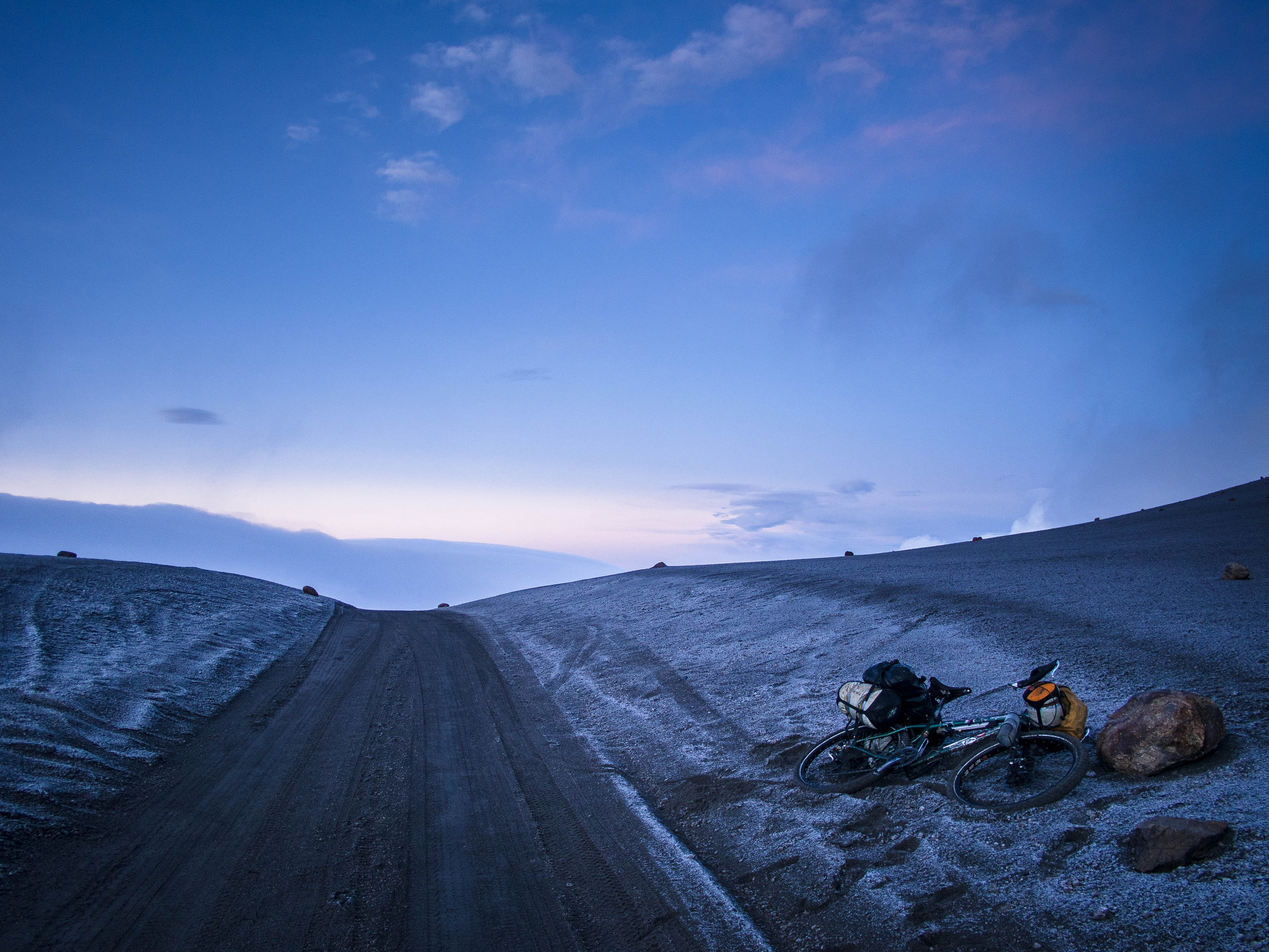
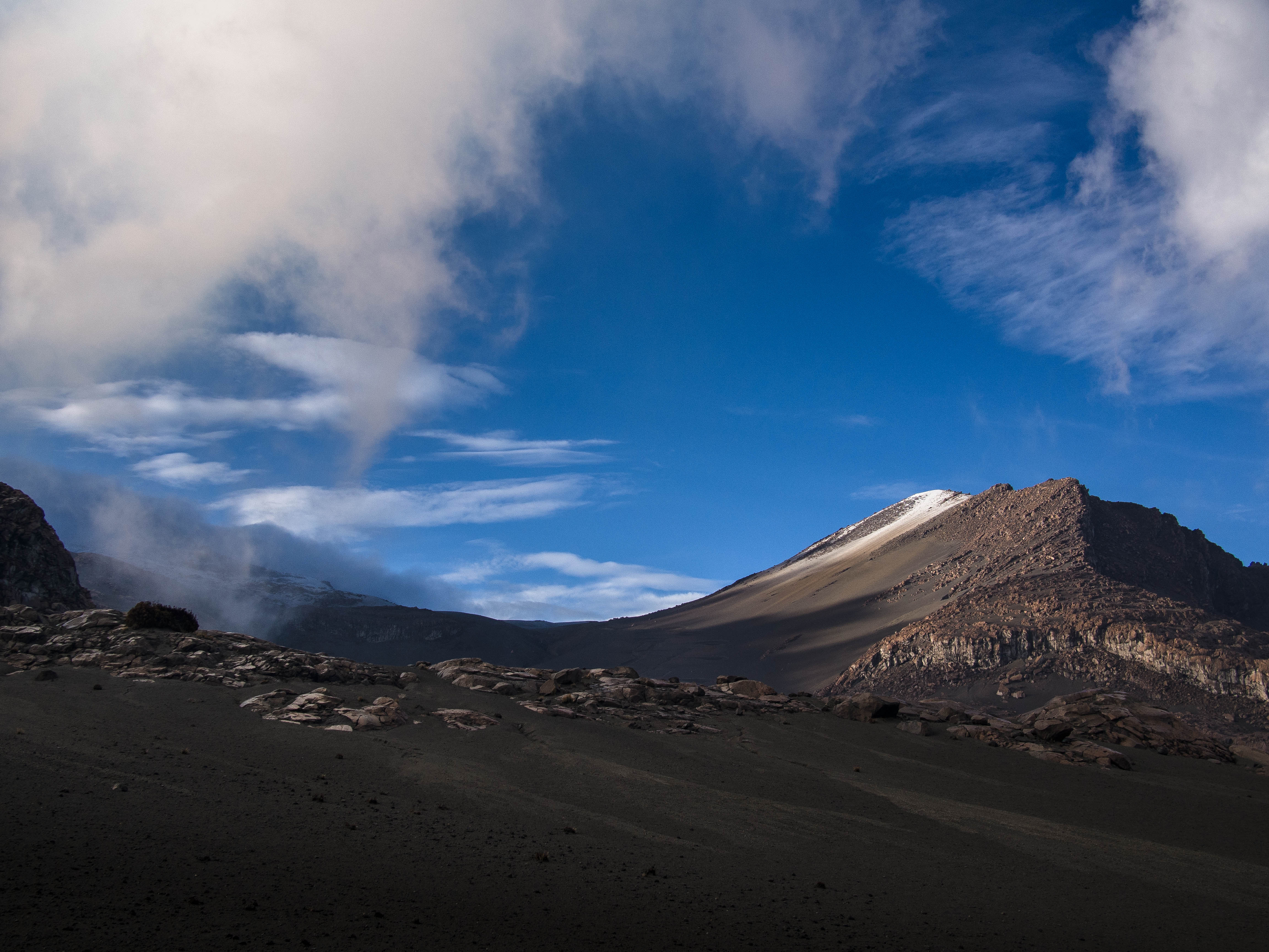
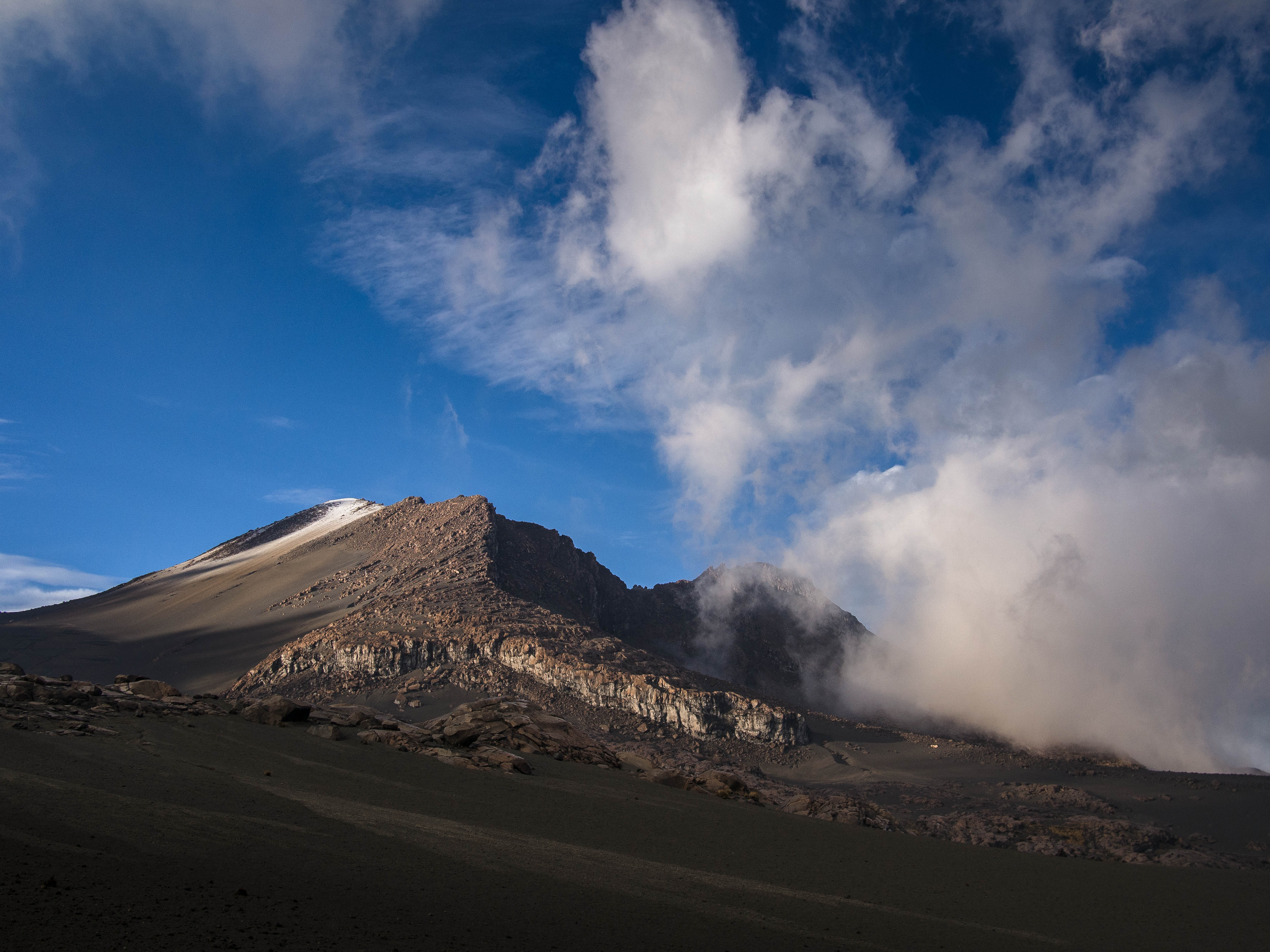
I finally reached the top of the 4800m pass at around 5:30am, just as the weather started to clear and the first glimmers of light were appearing.
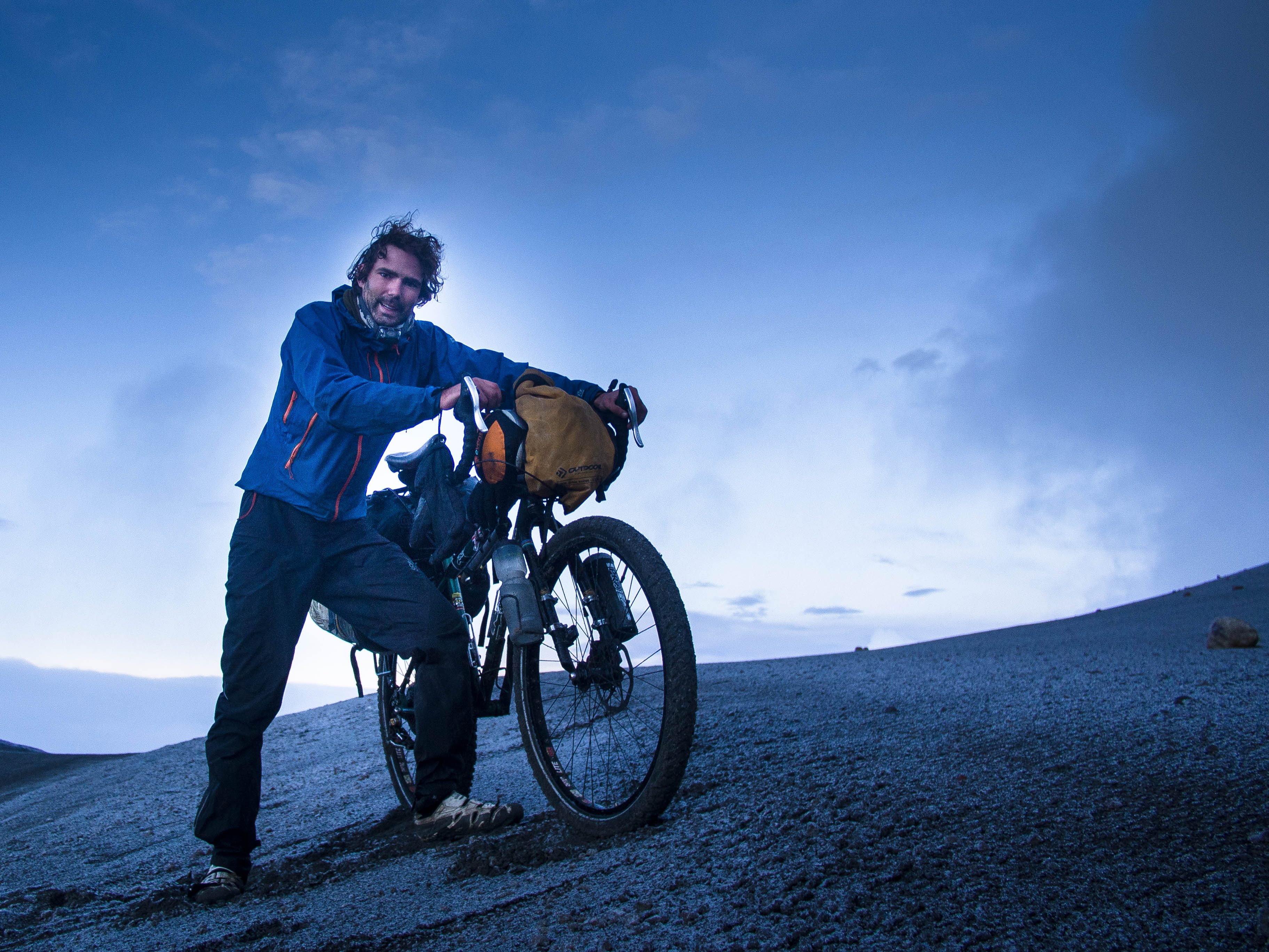
Slowly the spectacular luna landscape was unveiled and I was struck with a mixture of relief and awe. I’d done it.
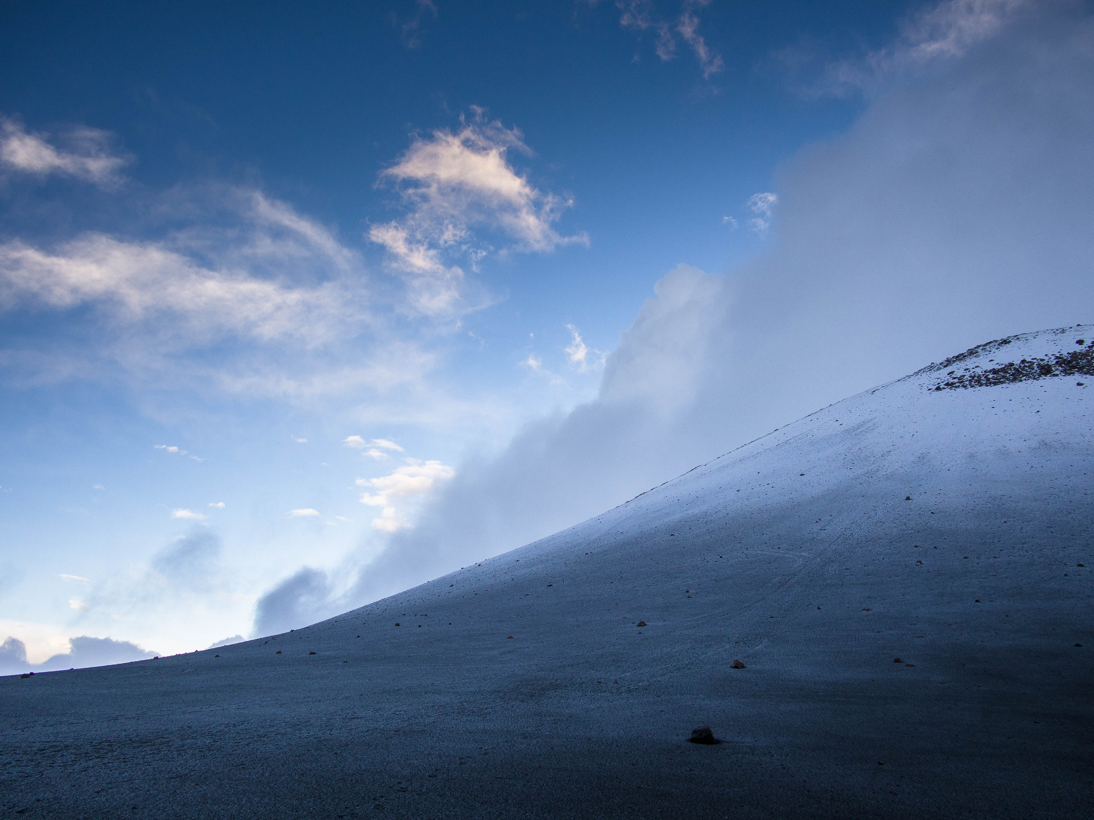
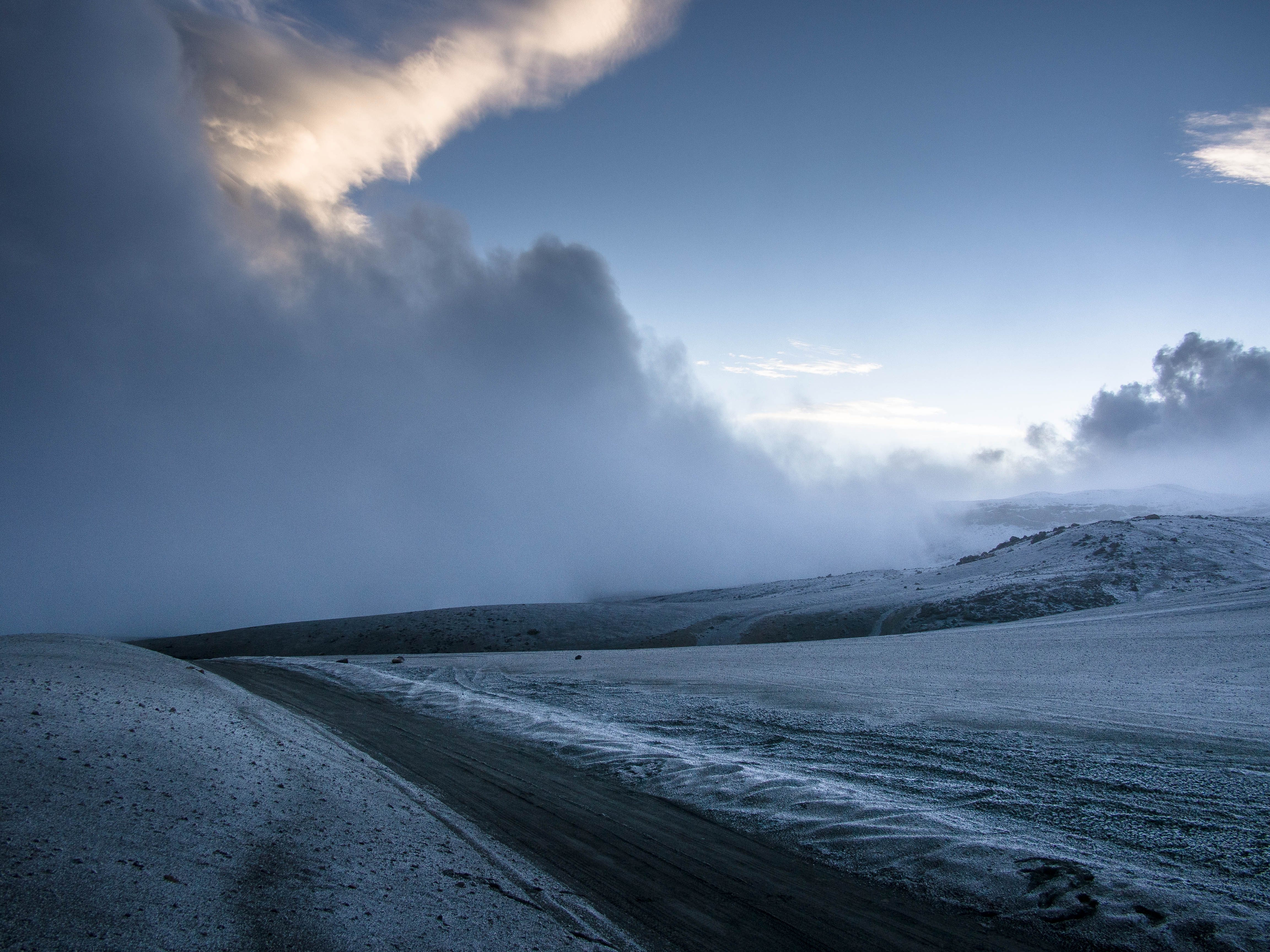
Descending down the other side I was soon out of the ‘forbidden zone’ and could start to finally relax and take in the incredible scenery that was unfolding around me.
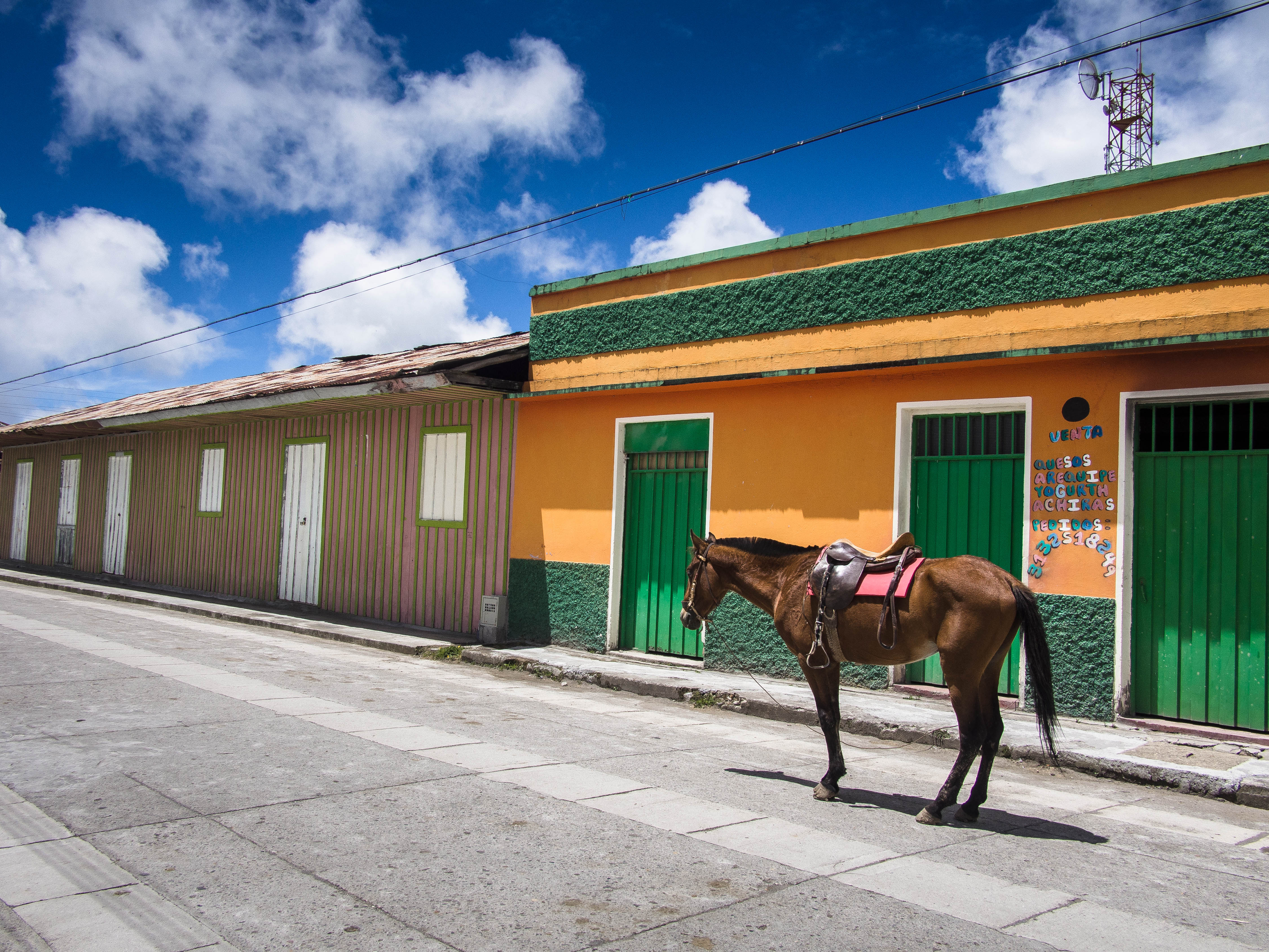
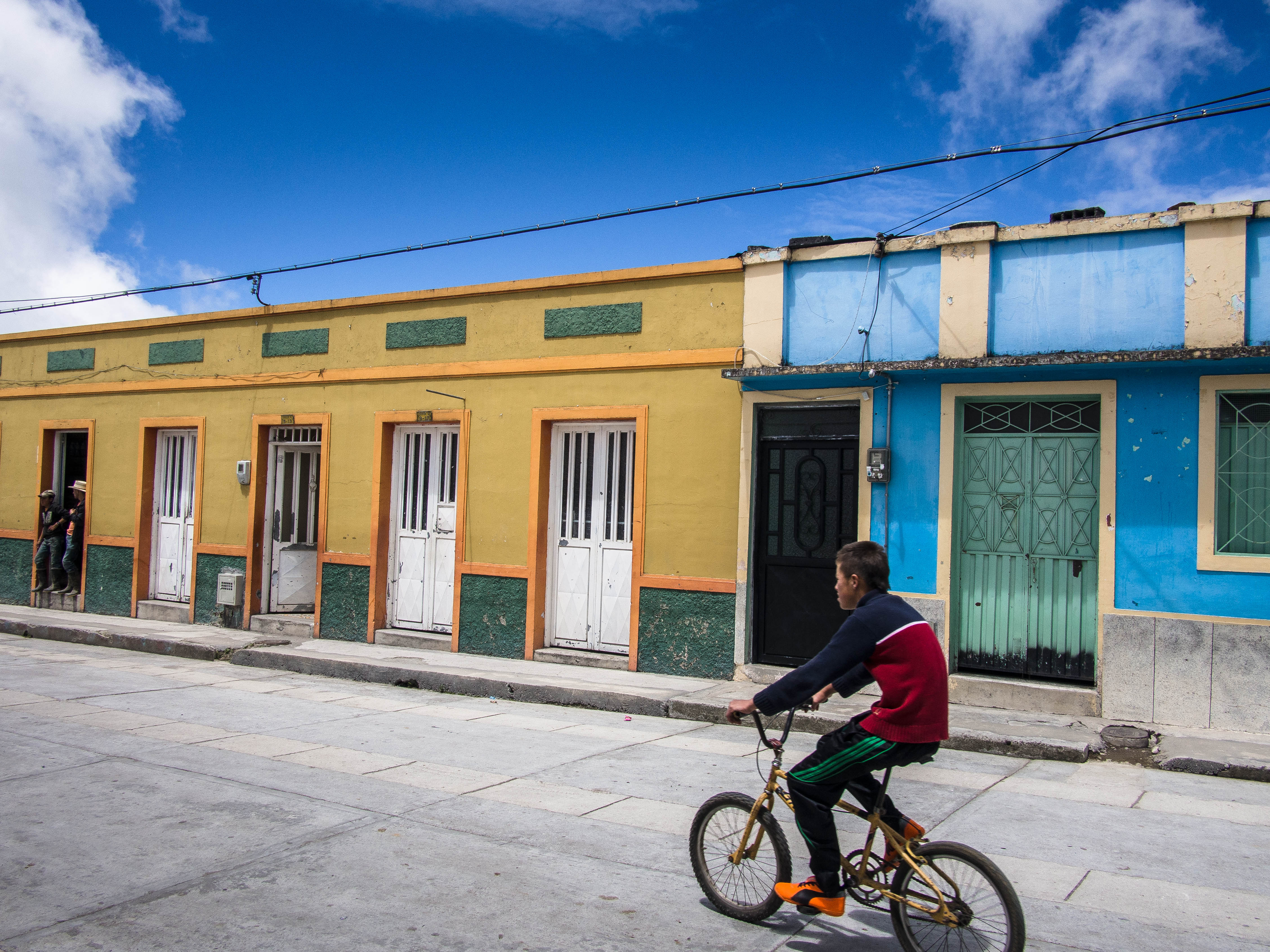
I continued on dirt roads towards the colourful village of Murillo and before long the events of earlier seemed like a distant nightmare.
Arriving back in civilization I felt like an unwashed castaway who’d just made his way back to land. Having barely eaten all day, food was top priority and I was so overwhelmed I barely knew where to start.
A roast chicken soon put things right and I decided to press on the town of Libano, where, at 1500m, the air was luxuriously warm and oxygen rich. Finally I’d made it through the mountains and now it was time to rest and reflect on what has to rank as one of the most challenging but equally spectacular bits of the trip so far…
ROUTE INFO
You can view my eventual route here, excluding my various excursions from Laguna Del Otun.
From Villa Maria:
0 km – Town of Villa Maria and beginning of dirt road climb
0-32km – Stony dirt road passing through innumerous small farms, becoming less frequent as you climb higher. 100% rideable, although this may not be the case in the wet due to the slippery rocks. Laguna Hostel located at 22km mark, just after crossing the river. La Playa Farm located at 31km, a possible camp spot. Los Alpes Farm located at 32km (~3000m altitude) where I camped. Also a good place to get some milk!
32-46km – Some of the steepest sections, although still 99% rideable Towards the end of this stretch you’ll pass a small park office and another largish farm ‘La Cueva’ which was recommended for camping. The junction with the dirt road running North-South through the park is reached at 46km and the best of the Paramo starts.
South of the Junction:
0-7km – Similar road conditions, 100% rideable, big decent followed by a climb up to Potosi after 7km. There is a ranger station here as well as an abandoned looking farm, Campoalegre, where you can apparently get dorm style accommodation or in the least camp outside. From here the main road heads West back in the direction of Villa Maria, but I was reliably informed there’s also a left turn at some point that will take you to Santa Rosa via some thermal pools. This is a new road that doesn’t appear on maps.
7-18km – From Potosi a non-vehicular route continues south to Laguna Del Otun. This is challenging riding with loose rocks making the riding difficult. I’d say 60% rideable loaded, but a good option would be to do this as an unloaded side trip from Potosi in which case it may all be rideable depending on ability. Following a cracking decent down to the lake there’s the option of crossing over to the camping area on the opposite side. This is a great spot but the 2km or so trail leading to it is a nightmare by bike and completely unrideable. The camping area is free but there’s a flush toilet and sink with water supply you can use. It’s shared with a ‘Ministry of Interior’ building, which is permanently manned by friendly park rangers.
From the lake further progress south by bike is effectively impossible. The trails are just too steep and rocky to make it worthwhile. Great for hiking though and it would make a great base for tackling Santa Isabel.
North of the Junction:
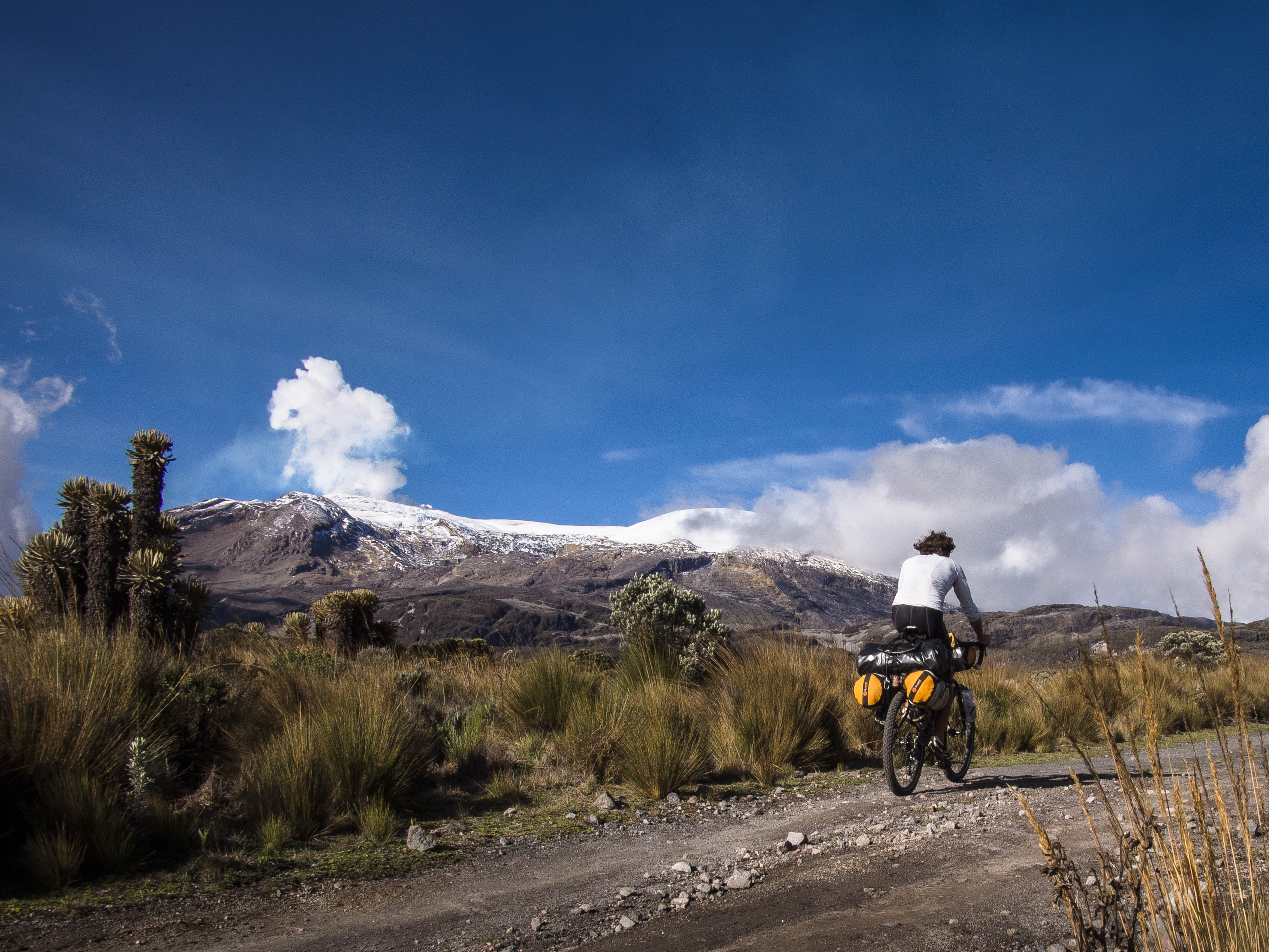
0-8km – Another tricky stretch of dirt road, although 100% rideable and offers stunning views of Nevado Del Ruiz and neighbouring peaks across the Paramo. After 8km you reach the gate that signals the start of the closed section of road leading to Nevado Del Ruiz. It’s fairly easy to push the bike over the Paramo and go round the gate and then you almost immediately arrive at the abandoned El Cisne Refugio and Education Centre. This is a good spot to camp and there is a hose pipe round the back of the Education Centre for water.
8-28km – This takes you to the top of the pass and has been off limits for some years and looks destined to be in the future. Proceed at your own risk. Similar stony track with a couple of streams to cross, 95% rideable. Towards the top of the pass the terrain turns to dark sand which makes riding difficult.
Decent to Las Brisas (Distance Unknown) – This starts off as a very sandy switchback descent, with care needed on the corners. There were some sulphurous fumes at this point but seemed relatively mild compared to volcanoes climbed previously (eg Telica in Nicaragua). The views are stunning. You know when you’re out of the ‘forbidden zone’ as there’s a rope slung across the road a couple of km down from the top of the pass.
From the Las Brisas entrance buildings your straight onto the road to Murillo (45km away). Up until 8km before Murillo this is more of the same stony stuff, making for a pretty bone jarring descent. After this point the asphalt starts in drips and draps, being continuous after Murillo.
Misc Notes:
- Entering the park from this direction, as opposed to the main entrance at Las Brisas, means you can avoid paying the entrance fee.
- This is a good map of the road/trail network here (although as I discovered some of the hiking trails don’t really exist anymore).
- The owner of Kumanday Adventures in Manizales, Juan, is an avid biker and great source of knowledge on routes in the park.
- Also feel free to contact me if you have any questions.

Breathtaking, you have amazing stamina Paul, good luck as you continue your adventure., Sheila Marshall.
awesome! absolutely love it – great adventure. Would you recommend the route overall? love the covert night operation, must have been intense 🙂 hopefully we can share a couple of adventures further south. how is the new bike setup?
Cheers Nick, definitely recommended because of the stunning paramo and the fact you basically have the whole national park to yourself, but it’s a shame about the road closure as covert night operations are quite stressful! The lighter set up is working well thanks, but I’m already eyeing up a frame bag to get some of the load off the back…
Hey Paul!
Got my website all done! My trip is now starting on Sept 16th which is a relief! Bought a Salsa fargo 2 today that I am going to use for the trip! really excited for that! I plan on only having rear racks as well.
How much water do you carry for the day? Is water pretty abundant? where did you stow your laptop? mine is a 13 in air. I can carry two 64 oz of water on the fork in two insulated thermos’ is that enough for the day? If that was all I need I could use a frame bag for some stuff as well.
Hope everything is going great! Love the photos!
Patrick
Patrick, sorry I’ve only just seen this. Your site looks epic! Water has rarely been a problem for me, usually I just have two full bottles and refill often at rivers, taps in cafes/houses or just buy it. Purification tablets or some purification device will generally mean you can get away with carrying relatively little. The only tricky points are when I want to wild camp away from a water source (e.g. mexico’s baja) and in those instances I fill up my water bag in advance with 4 litres or so and just lash it to the back rack on top of the other bags. Further down the andes e.g. Bolivars salt flats it’s going to be a similar situation.
I’ve actually just ordered a frame bag as I want to get some of the weight off the back, I think they’re definitely the way forward. Currently my laptop resides in the ortlieb bag slung over the rear rack and is wrapped up in my down jacket for a bit of cushioning.
Good luck with the final preparations!
Paul
Pingback: The Triple Heart Bypass | THE RIDE SOUTH·
Thank for the write up, Paul! Was planning something similar in a couple of days. I was curious about the restricted areas, so will get an update in Manizueles. Any ideas how many days it would be from Salento? I was also thinking of doing a relatively light 5 day-6 loop out of Manizueles, via the park, paramo and coffee plantations.
Do you have a gpx file for the ride? I don’t seem to be able to access that file.
Cheers?
Hey Cass, Great to hear you’re planning a cheeky foray in the park, certainly worth a visit, but the restrictions are a bit of a nightmare…. Best to seek out Juan at his ‘Kumanday Adventures’ hostel & office, super helpful and knowlegable guy, who’ll let you the latest situation and show you his maps. I don’t have a gpx im afraid and Ive just noticed that link sends you to a wrong google map, which is brilliantly unhelpful.
There’s a reasonable map here> http://www.nevados.org/mapserver/parque-de-los-nevados.htm and all the dirt roads are marked on the ‘Open source landscape topo’ layer of Gaia. Basically I took the northern most of two dirt roads that lead up from Villa Maria (just next to Manizales) up into the park. Here you’ll intersect the main north to south road through the park at around 4000m, I first went south to Laguna Otun which is a great ride but effectively a dead end, and then went north past Nevado Del Ruiz and through the restricted zone to pop out at the ‘Las Brisas’ main entrance and link up Manizales / Murillo road. This would make a cool all rideable loop from Manizales with Laguna del Otun an optional, more technical, side trip, but I fear the restrictions will still be in place… A complete overkill if they are, but it’d be a bit of a gamble whether you’ll run into a ranger driving along that stretch who’ll then send you back. Basically a case of pushing round a gate just before the closed El Cisne Refugio and then there’s just a rope across the road on the north side of the Nevado del Ruiz pass.
No idea about the salento ride I’m afraid…
Good luck!
Paul
Oops. Comment sent before being finished…
Cheers!
Cass
Paul,
Nick and I retraced your route, including a 3am start to avoid the dastardly guards stationed along the ‘closed’ road. As it happens, a fair bit seems to have changed. The abandoned refuge beyond the gate is now definitely in active use. We passed by at night, and just kept walking, camping a little beyond eyeshot, and starting early the next day. Lots of snow on the pass top, as we’d experienced heavy rainfall prior (travelling mid April).
The entry into the main refuge at Las Brisas is closed off by a gate, so no sailing past with a gringo wave. However, the rangers working there were extremely nice, explaining to us that the road we’re ridden was officially closed due to seismic activity – so we knew ‘for next time.’ In short, I think the park officials are clamping down on people riding across the area. A real shame, as it’s a stunning ride and the perfect way to make a loop out of Manizales – which is what we did, plummeting back down on a jungle dirt road to town, rather than heading out to Murillo.
Also – fees are now collected at Potosi – the good news though is that the foreigner price has been decreased to $25,500, and we were able to negotiate a ‘cyclists discount’. Again, super friendly park rangers. We rode to Lago del Otun (99% rideable on the Krampus!), stashed our bikes and walked the last 2km. The following morning, we hiked up to one of the smaller lagunas. With more time, a hike to the glacier would be great – 7 hours there and back, apparently.
We weren’t blessed with much sunshine during the few days we were in the park, but it was still an awesome, beautiful experience. It ranks up there with the best of the Ecuadorian paramo. Thanks for the ideas and inspiration!
Great to hear you guys made it! I’m looking back on it now in a rose tinted haze, but I can remember that night assault being pretty horrendous at the time….
Sorry to hear you found the Refugio open, I found myself a nice little spot for the night in the unlocked education centre restroom!
Funnily enough, down in rainy Cochrane, we’ve just been looking over your notes on Paso Roballo. Heading up and over to Argentina tomorrow.
Cheers
Paul
Hey, Thanks for the update. You never found a way all the way across to Salento then? Strava has plotted me a route, but that doesn’t mean anything really.
Hoping to make the ride in December.
Thanks.
Joshua
Again, a pretty epic and thoroughly inspiring bit of touring madness. I’m very much looking forward to getting into it on my own; in the meantime, the pics are excellent!
Thanks Matthew, you’ll love it!
Pingback: Bike Touring Colombia – Medellin to Nevado Del Ruiz – Brian's Routes·
Awesome route! I am looking at riding there in December. How would it work in the opposite direction?
Pingback: Bikepacking Parque Los Nevados, Colombia. – The Traveldex99 Blog·
Pingback: Bikepacking Parque Los Nevados, Colombie. - Wordpress·
Pingback: Bikepacking Parque Los Nevados, Colombia. | Webzoly·
Thanks. Excellent Write up.. Really usefull. Almost makes me think twice about trying something similar. I’m really keen to find a way across to the Salento area.. but starting to think it might not be possible.
Thanks,
:Joshua